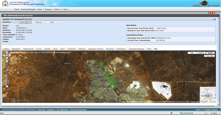
The Map tab displays the selected tenement overlayed on Google maps. The displayed tenement and imagery is for information and location purposes only.
Only live (green) and pending (blue) tenements will be shown.
When a live or pending tenement is displayed using 'Title Information' and the 'Map' tab is selected, the tenement will be displayed overlayed on Google maps.

Functionality
| Zoom in/out |
|
| Pan |
|
| Map button | Will display a mapping view. |
| Satellite button | Will display a satellite image view. |
| Hybrid button | Will display the satellite and mapping views combined. |
| Fullscreen button | Will open a new eMiTS handle with tenement and image data expanded to the full extent of the frame. The original handle still remains. |
| Coordinate selection |
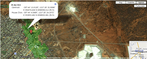
When the mouse pointer (cross hair) is within the Tenement and the LH mouse button is pressed a pop-up caption will display showing the centroid of the Tenement (polygon) and cursor location in Geographical (GDA) and UTM coordinates.
|
Notes:
1. Tengraph is the authoritative source of 'spatial' tenement information.
2. The imagery is sourced directly from Google maps.
3. The Tenement boundaries are determined by querying an internal Mapping Service, that accesses current Tenement data populated from Tengraph.
Messages:
1. The mapping frame will display with an Information message for Tenement with a status other than live or pending.
2. The mapping frame will display with an information message 'Mapping Service is currently unavailable - contact Service Desk'.
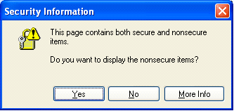
3. If you see the following warning when displaying a Tenement on top of Google Mapping in Internet Explorer 8 . Select the 'NO' button and the mapping will be displayed
.gif)
If you see the following warning when displaying a Tenement on top of Google Mapping in Internet Explorer 6 & Explorer 7, select the 'YES' button and the mapping will be displayed.


