Forthcoming geophysical data releases
Thursday 26 April 2012 after 0900 AWST (UTC +8)
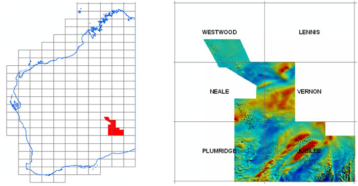
Jubilee 2010 airborne magnetic and radiometric survey — final data
Images and grids of final data from the regional magnetic and radiometric survey at line spacing of 200 m completed in June 2011 will be available from the GSWA website on the Regional Geophysical Surveys page.
Point-located ('vector') data and grids from this survey can be purchased on disk from Geoscience Australia or downloaded free of charge from the Geophysical Archive Data Delivery System (GADDS).

Preliminary grids and images were released on 22 December 2011 and are available for download from http://www.dmp.wa.gov.au/14582.aspx
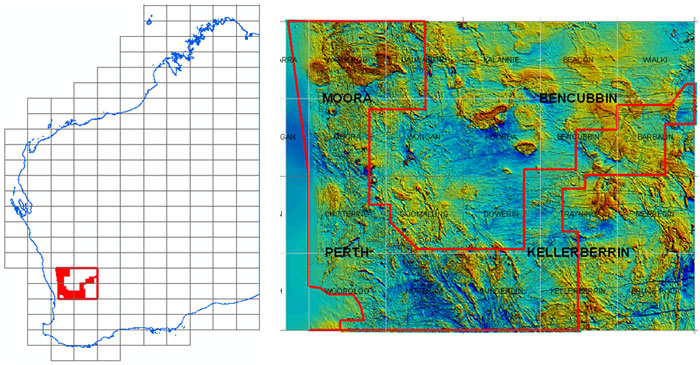
Moora 2011 airborne magnetic and radiometric survey — final data
Images and grids of final data from the regional magnetic and radiometric survey at line spacing of 200 m completed in June 2011 will be available from the GSWA website on the Regional Geophysical Surveys page.
Point-located ('vector') data and grids from this survey can be purchased on disk from Geoscience Australia or downloaded free of charge from the Geophysical Archive Data Delivery System (GADDS).

Preliminary grids and images were released on 22 February and are available for download from http://www.dmp.wa.gov.au/14374.aspx#14748
Access to previously released geophysical data
Image data from previous geophysical releases can be found on our Regional Geophysical Surveys page. Digital located and grid data can be purchased on media from Geoscience Australia or downloaded free of charge through the Geophysical Archive Data Delivery System (GADDS).
Latest releases
NON-SERIES BOOKS
Geological Survey of Western Australia newsletter: Fieldnotes April 2012 number 62
If you would like to receive a hard copy of GSWA's Fieldnotes quarterly newsletter, please email publications@dmp.wa.gov.au.
NON-SERIES DIGITAL PRODUCTS
Training in GSWA databases and online systems

You are invited to attend a free training session hosted by the Department of Mines and Petroleum to demonstrate current online systems. This is your opportunity to try these services for yourself and chat with the staff who create and manage them.
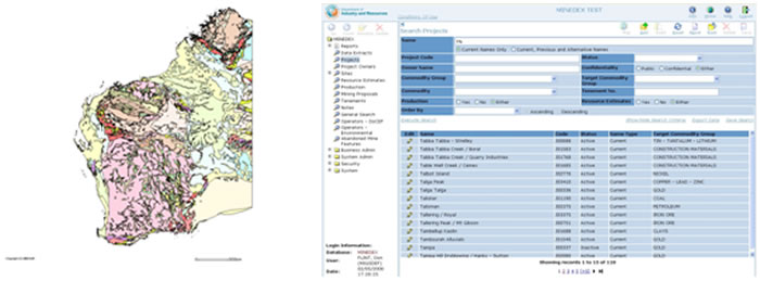
The format is an interactive presentation which includes navigating the DMP website, searching for publications, finding mineral deposits using MINEDEX, finding digital datasets using the Data and Software Centre, open file mineral exploration reports using WAMEX, and bringing it all together with the interactive map viewer (GeoVIEW.WA). GeoMap.WA, a new GIS viewer for Windows, will also be demonstrated.
The morning sessions will be a high-level fast demonstration and overview of the use of all the programs. At the afternoon sessions, participants will be able to practise using the programs with their own actual examples and get some one-on-one advice about individual issues. You can attend one or both sessions.
Kalgoorlie
WA School of Mines, Mine Design Lab, Room 131, Building 703, Odwyn Jones Building, corner Cassidy and MacDonald Streets, central Kalgoorlie.
9 am – 12 noon, 2–5 pm – Wednesday 27 June
or
9 am – 12 noon, 2–5 pm – Wednesday 14 November
Perth
ISB Training room, 3rd floor South
Mineral House, 100 Plain Street, East Perth
9 am – 12 noon, 2–5 pm – Wednesday 7 November
To register, email your details to publications@dmp.wa.gov.au.
Masterclass and lecture: Professor Jean-Pierre Burg
Institute of Geology, ETH Zurich and 2012 UWA Gledden Visiting Senior Fellow
Alpine-Himalayan System — masterclass
Date: Wednesday, 28 May 2012
Time: 10 am – 4 pm (includes a light lunch)
Venue: Old Senate Room, IAS, UWA
Cost: Free but registration is essential
Register via: http://www.ias.uwa.edu.au/masterclass
Registration close: 21 May or until full
Enquiries: 6488 1340 or www.ias@uwa.edu.au
Where the stressed Earth fails: The Himalayan syntaxes — lecture
Date: Tuesday, 29 May 2012
Time: 4 pm – 5 pm
Venue: Gentilli Lecture Theatre, First Floor, Geography Building, UWA
Parking: P18 and P19, entry via Fairway entrance No 1
Spotlight on a product
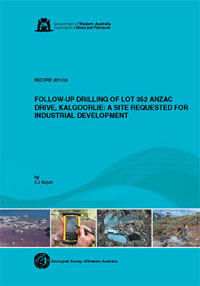
Record 2011/24 Follow-up drilling of Lot 352 Anzac Drive, Kalgoorlie:
a site requested for industrial development
by CJ Kojan

In early 2011, the Department of Mines and Petroleum (DMP) completed a follow-up program of Rotary Air Blast (RAB) sterilization drilling over parts of Lot 352, Anzac Drive, on the western outskirts of the City of Kalgoorlie–Boulder. This and a previous DMP sterilization drilling program were undertaken to ensure there is no potential for significant economic mineralization on this site, which has been identified as otherwise suitable for the expansion of the West Kalgoorlie industrial area. The results of this program have recently been published as Record 2011/24.
The follow-up program of drilling and other geological fieldwork was undertaken by Kalgoorlie Geological Consultants. Drilling was completed on 26 February 2011, with 86 holes drilled for a total of 4210 m. Four-metre composite samples were submitted for gold analysis, and end-of-hole (EOH) samples were also analysed for a multi-element suite. Anomalous intersections (gold or multi-elements) were later resampled at one-metre intervals. A quality-control assessment of gold results indicated good precision and accuracy. These data were then used to create a revised geological interpretation, and summary of near-surface gold anomalies and anomalous gold intersections in the project area, presented here in plans and sections.
These results demonstrate that there is very low potential for economic deposits of supergene or primary gold mineralization suitable for open-pit mining in the project area. Likewise, there is very low potential for economic deposits of nickel or base metals. Therefore, the proposal to release Lot 352 Anzac Drive for industrial or other purposes should be supported.
Access GSWA products
You can download maps, reports, and digital information free of charge from our website.
Click on these links to take you to the download page for that product:
- Geoscience information, maps and reports
- GIS versions of maps
- Interactive geological map (GeoVIEW.WA)
- Promotional flyers and posters
- GeoMap.WA GIS software
- Mineral deposits and mine information (MINEDEX)
- Mineral exploration reports (WAMEX)
- Petroleum and geothermal information (WAPIMS)
- TENGRAPH online
- Airborne geophysics index (MAGIX)
- Geochronology
- Geochemistry (GeoChem Extract)
- Petroleum Geothermal Register (PGR)
Hard copies
Hard copy publications are also available to purchase from the eBookshop or the First Floor counter at Mineral House, 100 Plain Street, East Perth, WA 6004.
Contact us
For information on publications, email publications@dmp.wa.gov.au
or telephone +61 8 9222 3459/ fax +61 8 9222 3444.
For information on digital data, email the Digital data administrator on gsd.dda@dmp.wa.gov.au
or telephone +61 8 9222 3816.
Physical address
Mineral House
100 Plain Street
East Perth WA 6004
www.dmp.wa.gov.au/gswa
For more information about GSWA and its products, go to the GSWA website.