Forthcoming geophysical data releases
Thursday 6 September 2012 after 0900 AWST (UTC +8)
Collie 2011 airborne magnetic and radiometric survey — final data
Images and grids of final data from the regional magnetic and radiometric survey at line spacing of 200 m completed in December 2011 will be available from the GSWA website on the Latest Geophysical Surveys page at www.dmp.wa.gov.au/geophysics.
Point-located ('vector') data and grids from this survey can be purchased on disk from Geoscience Australia or downloaded free of charge from the Geophysical Archive Data Delivery System (GADDS).
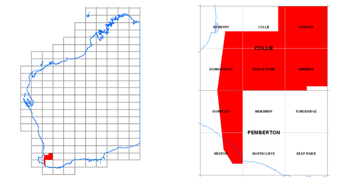
Preliminary grids and images were released on 22 February 2012 and are available for download from www.dmp.wa.gov.au/14374.aspx
Most recent geophysical data releases
| Date | Survey | Data status |
| 15 Aug 2012 | Magnetic anomaly grid (80m) of Western Australia | Update |
| 09 Aug 2012 | Murgoo 2011 airborne magnetic & radiometric surve | Final |
| 02 Aug 2012 | Perth Basin 2011 airborne magnetic & radiometric survey | Final |
| 26 Jul 2012 | Corrigin 2012 airborne magnetic & radiometric survey | Final |
| 05 Jul 2012 | Radiometric anomaly grids (100m) of Western Australia | Update |
| 28 Jun 2012 | Waigen-Mason 2010 airborne magnetic & radiometric survey | Final |
Latest Geophysics Program update
Access to previously released geophysical data
Image data from previous geophysical releases can be found on our Regional Geophysical Surveys page. Digital located and grid data can be purchased on media from Geoscience Australia or downloaded free of charge through the Geophysical Archive Data Delivery System (GADDS).
EIS Round 6 applications open for co-funded drilling program
Applications for grants for drilling to be undertaken in the 2013 calendar year will be open between 3 September 2012 and 5 pm WST, 5 October 2012.
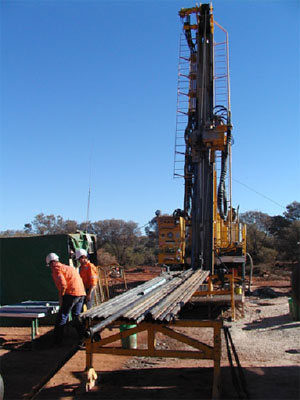
Over $5 million will be made available for co-funding of projects in this round.
A category providing co-funding of up to $30 000 is available for genuine prospectors.
Co-funding in all categories of applications will remain at up to 50% of direct drilling costs which will be capped at $150 000 for general, multi-hole applications, $200 000 for a single-hole application and $30 000 for a prospector application. Co-funding will be available for exploration drilling only. Resource definition drilling will not be eligible for co-funding.
The grant process is competitive with marks (detailed in the application forms) being assigned to the various criteria. Applications will be ranked according to the total marks gained and funding allocated until it is exhausted.
Online application forms will be deployed on www.dmp.wa.gov.au/eisdrilling between 3 September and 5 pm WST, 5 October 2012 for lodgement of applications. Applicants will be guided through questions which will address administrative as well as technical criteria.
The evaluation is undertaken by an independent panel of exploration geologists who have significant industry experience in WA. Members of the panel are required to abide by strict guidelines to ensure the highest level of integrity in the evaluation of applications, and the process is scrutinized by an independent probity auditor.
The program has already produced a number of projects which have been both commercially and scientifically successful. Projects which have previously obtained funding include Beadell's Handpump gold project, Encounter Resources' Yeneena copper project, Toro's Lake MacKay project, Alchemy Resources' Magnus gold project, Saturns Deep drilling at Mount Magnet gold mine, Beadell's gold find in the Tropicana Belt, Atlas Iron's drilling at the Hickman project and Cazaly Resources' iron ore drilling in the Earaheedy Basin.
For more details see www.dmp.wa.gov.au/eisdrilling
or contact Margaret Ellis, Co-ordinator EIS, on (08) 9222 3509.
Latest releases
RECORDS
Record 2012/11 Yilgarn Craton: geological setting of gold and nickel deposits in the Eastern Goldfields
by Wyche, S

NON-SERIES BOOKS
Fieldnotes: A Geological Survey of Western Australia Newsletter:
July 2012 Number 63
Geological Survey of Western Australia calendar 2013
by Johnston, J, Riganti, A
(available online in September)
Geological Survey of Western Australia review - 2012
PETROLEUM STATE ACREAGE RELEASES
The following releases will be available on 6th September, 2012
Geology and petroleum prospectivity of State Acreage Release Areas L12-10 to L12-13, Canning Basin, Western Australia
Geology and petroleum prospectivity of State Acreage Release Area L12-14, onshore Southern Perth Basin, Western Australia
Prospectivity of State Acreage Release Areas L12-15 and L12-16, Fitzroy Trough and Pender Terrace, Canning Basin
Geology and petroleum prospectivity of state acreage release areas L12-8 and L12-9, Canning Basin, Western Australia
GEOLOGICAL SERIES MAPS 1:100 000
Southern Cross, WA Sheet 2735
by Doublier, MP
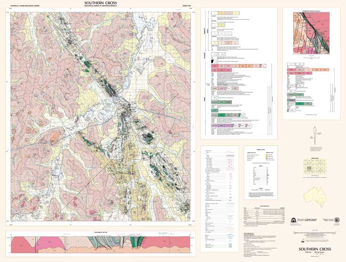
Digital data is available on USB for $55 (inc. GST). All other products are free to download as PDFs.
Training in GSWA databases and online systems
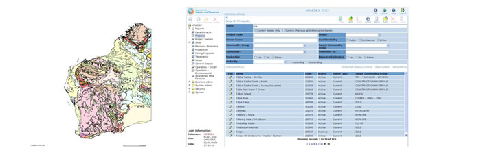
You are invited to attend a free training session hosted by the Department of Mines and Petroleum to demonstrate current online systems. This is your opportunity to try these services for yourself and chat with the staff who create and manage them.
The format is an interactive presentation which includes navigating the DMP website, searching for publications, finding mineral deposits using MINEDEX, finding digital datasets using the Data and Software Centre, open file mineral exploration reports using WAMEX, and bringing it all together with the interactive map viewer (GeoVIEW.WA). GeoMap.WA, a new GIS viewer for Windows, will also be demonstrated.
The morning sessions will be a high-level fast demonstration and overview of the use of all the programs. At the afternoon sessions, participants will be able to practise using the programs with their own actual examples and get some one-on-one advice about individual issues. You can attend one or both sessions.
Perth
ISB Training room, Ground floor
Mineral House, 100 Plain Street, East Perth
9 am – 12 noon, 2–5 pm – Wednesday 7 November
Kalgoorlie
WA School of Mines, Mine Design Lab, Room 131, Building 703, Odwyn Jones Building, corner Cassidy and MacDonald Streets, central Kalgoorlie.
9 am – 12 noon, 2–5 pm – Wednesday 14 November
To register, email your details to publications@dmp.wa.gov.au.
Spotlight on a product
Record 2012/11 Yilgarn Craton: geological setting of gold and nickel deposits in the Eastern Goldfields
by Wyche, S
The Yilgarn Craton in Western Australia contains evidence of the oldest crust on Earth. Greenstone successions developed after c. 3000 Ma show a complex history of juvenile crust generation and crustal reworking. There are at least three periods of greenstone-related magmatism in the Yilgarn Craton. The earliest recognized greenstone development consists of volcanic and sedimentary successions deposited between c. 3000–2900 Ma. A mantle plume at c. 2800 Ma produced large mafic–ultramafic igneous complexes and probably initiated rifting on the eastern side of the craton and incipient rifting in the NW. A second major plume, at c. 2700 Ma, was focused along the rupture created by the c. 2800 Ma event and may have been associated with the re-accretion of lithospheric blocks created by the earlier event. Komatiites generated by the c. 2700 Ma plume contain world-class nickel deposits, and structures developed subsequent to the peak of plume activity host world-class gold deposits. Recent studies of nickel and gold deposits in the Eastern Goldfields Superterrane have shown how features ranging in scale from the lithosphere to regional structural and stratigraphic controls to local volcanological and sedimentological variations can affect the size and distribution of deposits. This understanding is now being applied in exploration targeting.
Read more here
Geological Survey of Western Australia review – 2012
This review of the operations of GSWA was conducted by Economics Consulting Services for the Department of Mines and Petroleum. The focus of the review was on GSWA's capacity to manage both its recurrent programs and the Government's EIS. GSWA is a Division of the Department and has a brief to collect, synthesise, and publish information on the State's geology, and mineral and petroleum resources. This information stimulates effective exploration in the State and attracts new explorers. It also provides geological and land use expertise to Government decision making, particularly on economic and land use issues.
We have found GSWA to be a highly effective organization that is well managed and, given the EIS funds, well resourced. GSWA serves its State well. It is held in high regard by its key stakeholders with strong support for its programs and is regarded as a world-class Geological Survey.
We find the Geological Survey of Western Australia to be a
'World-Class Knowledge Resource'
Read more here
Access GSWA products
You can download maps, reports, and digital information free of charge from our website.
Click on these links to take you to the download page for that product:
- Geoscience information, maps and reports
- GIS versions of maps
- Interactive geological map (GeoVIEW.WA)
- Promotional flyers and posters
- GeoMap.WA GIS software
- Mineral deposits and mine information (MINEDEX)
- Mineral exploration reports (WAMEX)
- Petroleum and geothermal information (WAPIMS)
- TENGRAPH online
- Airborne geophysics index (MAGIX)
- Geochronology
- Geochemistry (GeoChem Extract)
- Petroleum Geothermal Register (PGR)
Hard copies
Hard copy publications are also available to purchase from the eBookshop or the First Floor counter at Mineral House, 100 Plain Street, East Perth, WA 6004.
Contact us
For information on publications, email publications@dmp.wa.gov.au
or telephone +61 8 9222 3459/ fax +61 8 9222 3444.
For information on digital data, email the Digital data administrator on gsd.dda@dmp.wa.gov.au
or telephone +61 8 9222 3816.
Physical address
Mineral House
100 Plain Street
East Perth WA 6004
www.dmp.wa.gov.au/gswa
For more information about GSWA and its products, go to the GSWA website.