Tengraph (Web) Help
- Frequently Asked Questions
- General
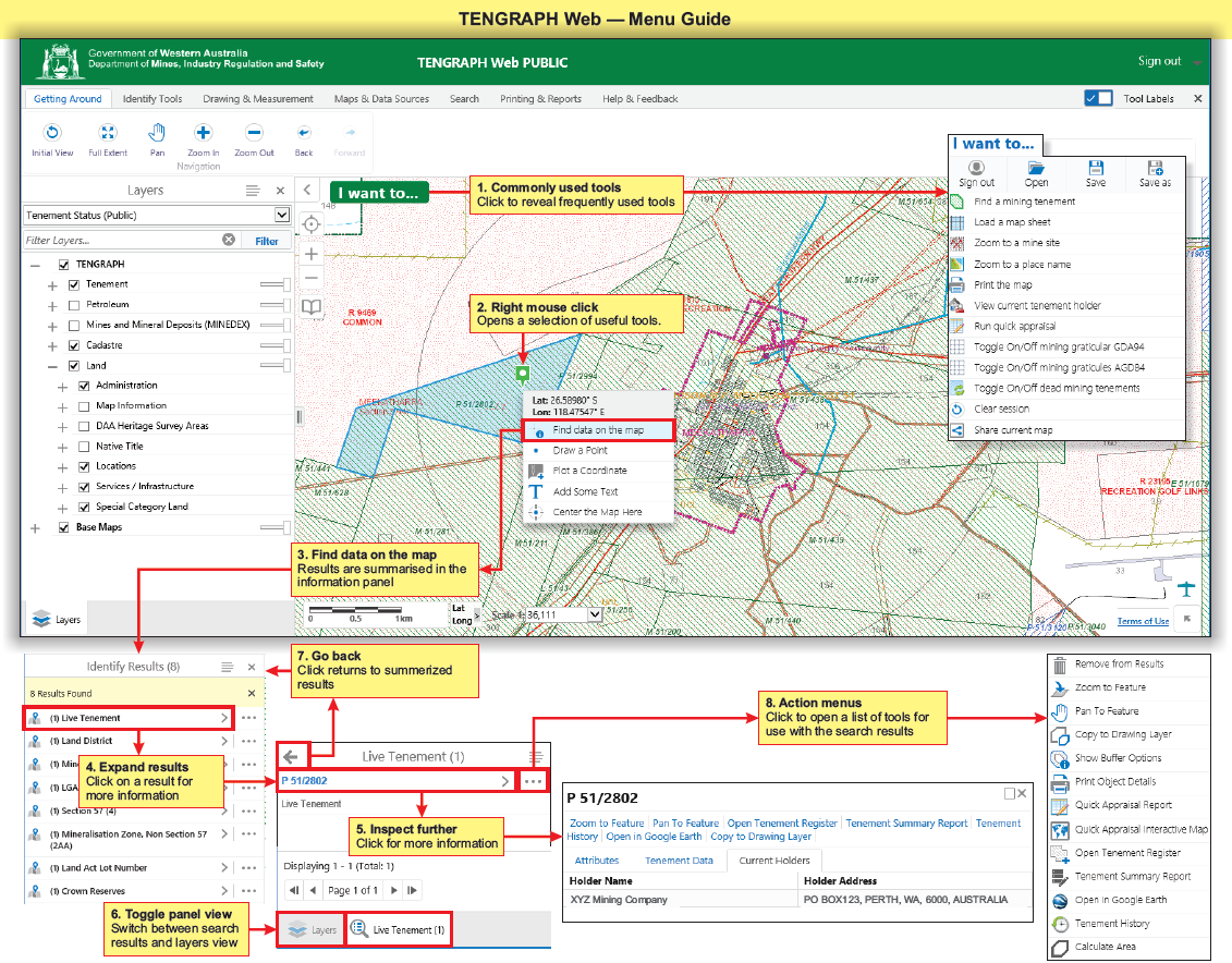
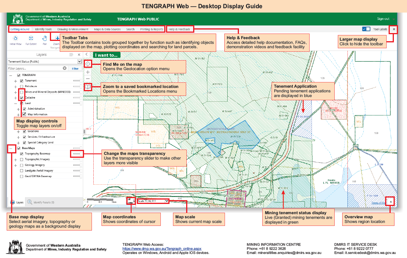
- Navigate Around the Map
- Map Layers
- TENGRAPH Tools (Feature Action Menu)
- TENGRAPH Tools (Results Layer Action Menu)
- TENGRAPH Tabs
-
TENGRAPH Drawing Tools Guide
- Create Drawing Tools
- Measurement Tools
- Snapping Tool
- Drawing Styles
- Edit Drawing Tools
- Clip Polygon
- Plot Coordinates
- Create a point at the Intersection of two lines.
- Create Line or Polygon by Bearing and Distance (Traverse)
- Create a Point on a Line
- AGD84 to GDA94 Coordinate Conversion Tool
- Create Graticule Polygon
- Copy a Map Feature/Object to the Drawing Layer
- Explode Polygon(s) to Points and Lines
- Print Constructed Polygon Details
- Save Drawings, Measurements and Text
- Base Maps
- Demonstration Videos
- Menu Shortcuts
- Projects
- Abbreviations and Prefixes
- Contact Us
- Smartphone Operation

