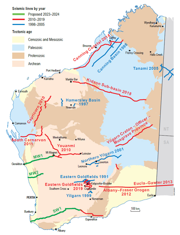
Deep crustal seismic reflection surveys
The Geological Survey of Western Australia (GSWA) undertakes collaborative projects with Geoscience Australia (GA), state Geological Surveys and Australian and international universities to investigate lithospheric architecture. Techniques used to image to the Moho and beyond include active source seismic refection, passive seismic techniques and magnetotellurics (MT). Often these are done across the same profile/area with additional gravity surveys.
Deep seismic reflection profiling has been part of the GSWA campaign to explore how the different components of the Western Australian landmass are configured and how they came together. It is a non-invasive geophysical technique for geoscientists to image geological features and structures throughout the whole thickness of the crust. By listening for the reflections of a source on the surface for length of up to 20 s, the deeper levels of the Earth’s crust, as deep as 60 km, can be explored.
Currently there are more than 7000 line-km of deep crustal reflection seismic surveys across the State. Several transects have been completed across various craton margins enabling the seismic characteristics of the basins, craton margins and other features to be imaged.
The resulting maps and models are used for various purposes including:
- imaging the deep geological architecture of the Western Australian landmass
- investigating how the different crustal components of Western Australia came together over the course of geological time
- identifying areas with potential for groundwater reserves or geothermal sources
- identifying areas that may be suitable for mineral or energy exploration
- land use planning.
How does it work?
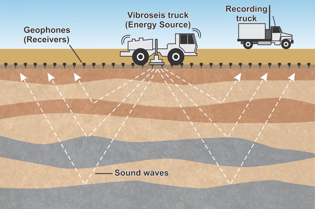
Reflection seismic surveying uses artificially generated sound wave vibrations to make images of the rocks below Earth's surface.
A field crew lays out the sensors (geophones) on the surface every 5 or 10 m along the road verge for 20 km or more along the path of the survey. Once the geophones are in place, the seismic waves are generated by two or three specialized ‘Vibroseis’ trucks. These vibrate the ground in unison to generate vibrations comparable in intensity to a road train passing by. The Vibroseis method was developed to allow seismic data to be acquired in urban and other sensitive environments by generating a controlled vibration that will not damage structures even in close proximity to the signal source. The seismic transects are usually sited along existing tracks and road verges to minimise any ground disturbance or the need to make new tracks. The Vibroseis trucks drive slowly along the line, stopping every 20–40 m to vibrate the ground for about 30 s through a steel plate lowered onto the surface. The vibrations spread into the ground and are reflected from deep rocks and structures. The reflected waves return to the surface where the time and strength of the waves is recorded by geophones.
As the survey progresses, geophones are collected from the rear of the line and taken to the data recording truck where the data are downloaded. They are then taken to the front of the seismic line to keep the survey rolling along. The recorded data are processed to make images of the crustal architecture in the project areas, and the structure, geometry and relationships between the various geological domains.
Watch How Reflection Seismic Surveys Work by GA.
Download an information sheet on seismic reflection surveys.

Data and results
All data from deep crustal seismic surveys (including operations and processing reports) are made publically available. Links to the data sets can be found below:
* indicates survey consisting of multiple lines
Older surveys are available from Geoscience Australia.
Publications
-
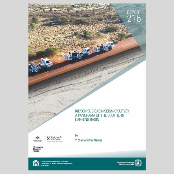 Report 216
Kidson Sub-basin Seismic Survey – a panorama of the southern Canning Basin
-
 Record 2017/8
The deep seismic reflection profile 11GA-YO1 in the west Musgrave Province
-
 Record 2017/5
Canning Coastal seismic survey — an overview of the Canning Basin
-
 GSSA Report 2015/29
What lies beneath the western Gawler Craton? 13GA-EG1E Seismic and Magnetotelluric Workshop 2015
-
 Record 2014/6
Albany–Fraser Orogen seismic and magnetotelluric (MT) workshop 2014
-
 Record 2013/6
Youanmi and Southern Carnarvon seismic and magnetotelluric (MT) workshop 2013
-
 Record 2011/25
Capricorn Orogen seismic and magnetotelluric (MT) workshop 2011
Contact
For more information contact:
geological.survey@dmirs.wa.gov.au

