Radiogenic isotope geochronology is used to determine the absolute timing of geological events, and is an essential component of geoscience programs at the Geological Survey of Western Australia (GSWA).
Access Geochronology (GeoVIEW.WA)
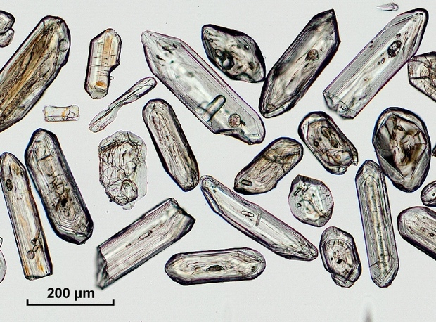
GSWA determines the ages of rock samples by measuring uranium, thorium and lead isotopes in zircon, baddeleyite, monazite and other minerals. The sensitive high-resolution ion microprobe (SHRIMP) in the John de Laeter Centre at Curtin University is used extensively, as are laser ablation inductively coupled plasma mass spectrometry (LA-ICP-MS) facilities in both the John de Laeter Centre and the Centre for Microscopy, Characterisation and Analysis (CMCA) at the University of Western Australia. GSWA also collaborates with Ar/Ar geochronology specialists at the John de Laeter Centre to determine the ages of cooling, deformation and crystallization of rocks containing potassium-bearing minerals.
Understanding crustal evolution, including the formation of mineral deposits, is enhanced greatly by combining geochronological information with radiogenic isotope data, such as Lu–Hf and oxygen analyses of zircon crystals and Sm–Nd analyses of whole-rock samples. Using these techniques to elucidate both the temporal and spatial evolution of crust and mantle, particularly in underexplored areas, provides an important tool for identifying new mineral provinces and improving exploration strategies in Western Australia. Lu–Hf, Sm–Nd, oxygen, and other isotope measurements, such as Re–Os and Rb–Sr, are obtained in collaboration with several university laboratories.
Geochronology and isotope geology information is best accessed using GeoVIEW.WA. This online interactive mapping system allows data to be viewed and searched together with other datasets, including geophysics, geological maps, and mineral exploration datasets.
The information provided in GeoVIEW.WA is updated regularly.
Other formats
GSWA geochronology and isotope geology information can also be obtained through the following links:
- Data and Software Centre — provides a downloadable ESRI Shape file, Google Earth KML file or MapInfo TAB file.
- eBookshop — where Advanced Search can be used to filter by author, year, sample number, map name, and other attributes (full functionality is still under development)
Contact
For more information contact:
geochronology@dmirs.wa.gov.au
For technical assistance contact IT Service Desk.