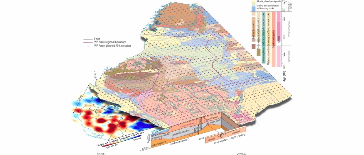
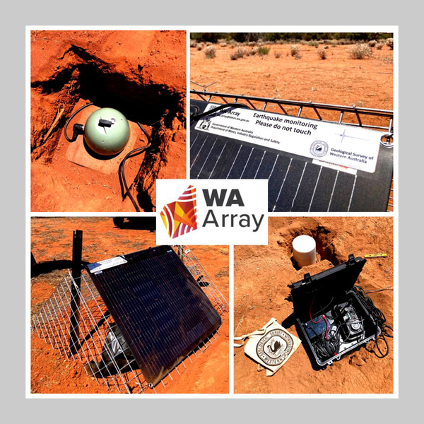
The WA Array project is a network of seismometers that will be deployed across Western Australia to identify the composition and structure of the State’s crust and lithosphere. This will help geoscientists better define areas of higher prospectivity under deep cover, evaluate future competing land uses, mitigate seismic hazards and maximise Western Australia’s opportunities in the transition to net- zero emissions. The program is a major logistical undertaking, representing one of the largest of its type completed anywhere in the world.
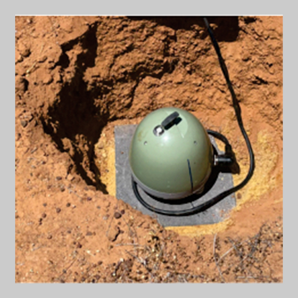
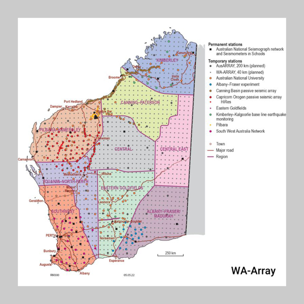
The project is funded by the State Government over a period of 10 years and is being run by the Geological Survey of Western Australia. Started in 2022, The project involves the deployment of an array of 165 seismometers arranged in a grid pattern spaced at 40 km intervals, with the entire State mapped by relocating the instruments annually between nine regional areas. Each station requires deployment, servicing, retrieval and rehabilitation. About 52% of the stations will require transport via helicopter, the rest will be accessed by road. As data is generated, it will be subject to a rigorous quality assessment process and review by seismologists before being made freely available to explorers, researchers and the community through the national AusPASS portal. Derivative spatial and 3D products will be available through DMIRS online geoscience data platforms.
Watch our YouTube video to discover more about WA Array.
The roll out of the program will prioritise regions according to areas of greatest expected resource development potential, with data being progressively released.
The net-zero challenge
The global transition to a low-carbon economy will support ongoing high demand for critical minerals to keep pace with investment in renewable energy generation and storage technologies. Western Australia’s future requires optimal strategic planning that balances the competing land uses required for the State’s transition to a low-carbon economy. Locations for renewable energy projects, including a potential future renewable hydrogen export industry must be balanced against exploring and developing future mines and associated potential downstream processing operations.
Western Australia is home to one of the most diverse and successful resource sectors in the world. It is a leading global producer of key commodities such as iron ore and gold, and critical minerals such as lithium, nickel and alumina; however, the declining rate of discovery of major new mineral resources has the potential to impact our ability to keep up with demand.
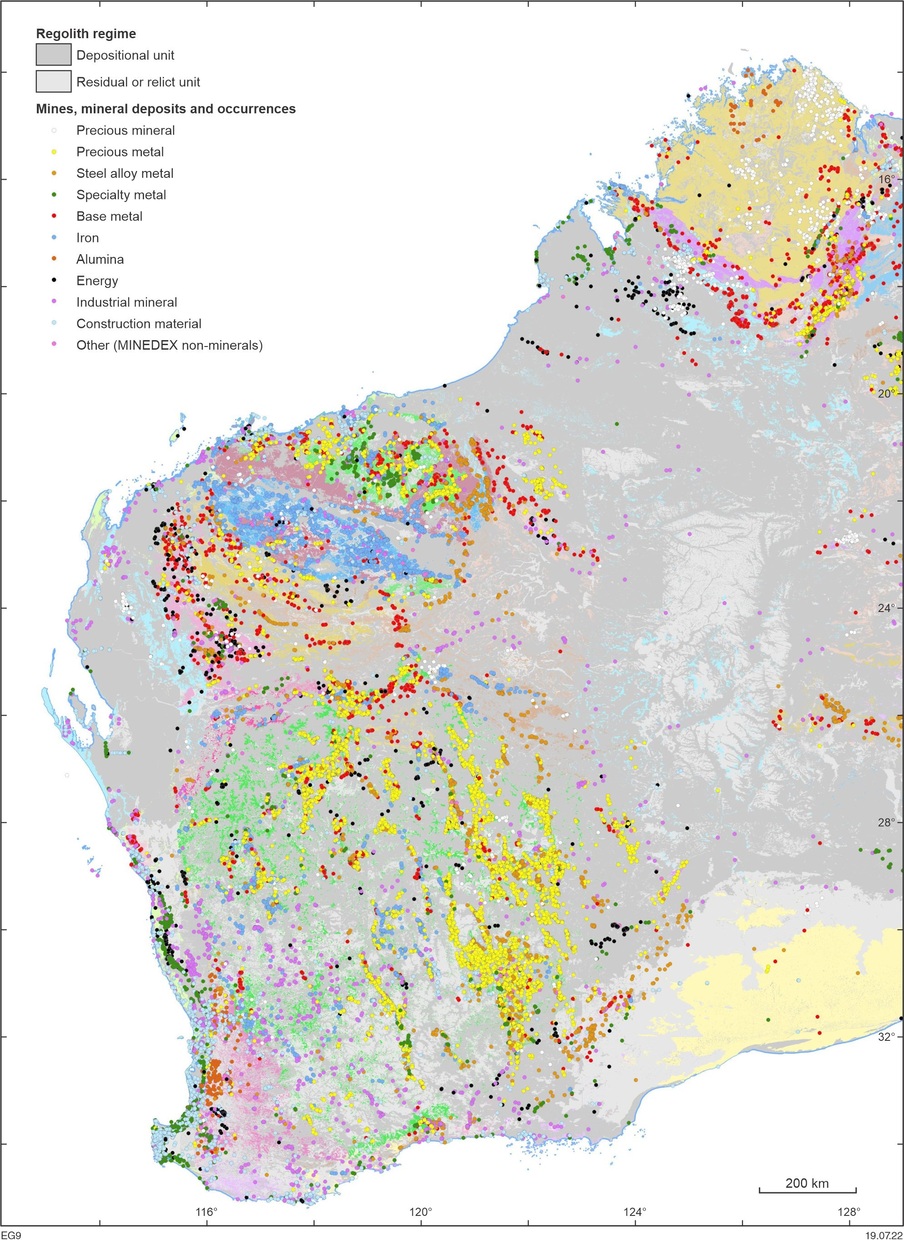
The issue to confront is that most of the known and mined mineral deposits occur in areas that are either close to the surface, or were otherwise ‘easy to find’ (see map at right). One of the key impediments to mineral exploration success is the blanket of sediments, sedimentary rock and weathered rock that conceals about 70% of prospective basement rocks.
The key to helping exploration companies pinpoint the probable location of these more concealed resources is through the application of geoscience technology like WA Array that can provide imaging of Western Australia’s geology at sufficient depths beneath the surface.
Locating prospective areas under cover
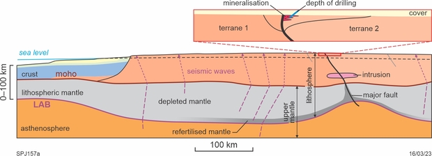
Continents are made up of blocks of lithosphere that have assembled through time. The sutures between these lithospheric blocks are fundamental structures of interest in the hunt for new mineral discoveries as they tap the deep Earth and as such can serve as major fluid conduits. ‘Ambient’ seismic noise from ocean waves and storms, and receiver functions (how an earthquake signal is shaped by its passage through the crust underneath the seismometer), can be used to ‘image’ the velocity structure and composition of the Earth. The lithosphere–asthenosphere boundary (LAB) is regarded as the bottom of the continental plate, and is a key and fundamental feature used for predicting the location of mineral deposits near the surface (see diagram below). Passive seismic studies with sufficient resolution are able to map this boundary, and the gradients within it, in detail and therefore provide critical information to mineral explorers as to where the sutures between major blocks exist
Seismic hazards
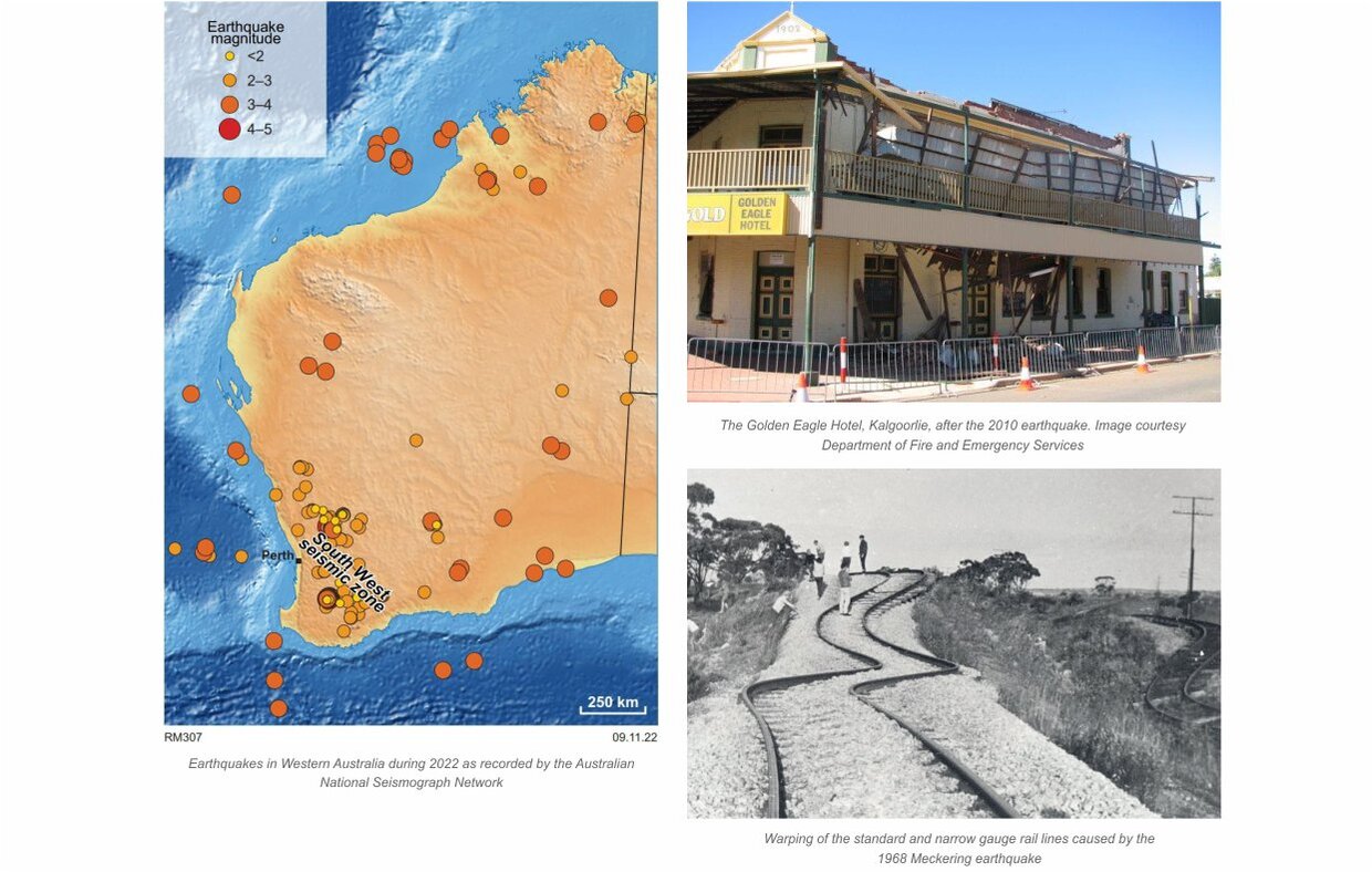
The South West seismic zone is one of the most seismically active regions in Australia, with swarms of earthquakes occurring regularly. The image below shows the magnitude (M) and location of earthquakes in Western Australia during 2022. WA Array will help to accurately map the loci of new earthquakes, allowing us to understand the geological setting for seismic activity and build a regional stress map. This knowledge can assist building codes, strengthen infrastructure, and help emergency services to identify high hazard areas.
Big earthquakes can occur in Western Australia and do serious damage. Such earthquakes include: Meckering in 1968 (M6.5; below, left), Cadoux in 1979 (M6.1), Kalgoorlie in 2010 (M5.0; below, right) and offshore Broome in 2019 (M6.6).
Project updates
News
Publications and information

Contact
For further information contact:
geological.survey@dmirs.wa.gov.au