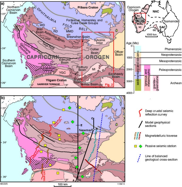
Two near-orthogonal magnetotelluric (MT) traverses were conducted across the eastern part of the Capricorn Orogen. The results show distinct variations in mantle and crustal electrical conductivity across the Orogen. They are interpreted to represent a series of discrete tectonic blocks separated by crustal-scale faults or shear zones, which dip towards the centre of the Orogen. By contrast, in the western part of the Orogen, the major structures consistently dip towards the south.
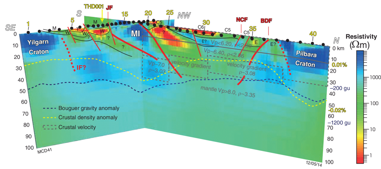
The 2011 broadband MT survey of the East Capricorn Orogen has indicated the Yilgarn and Pilbara Cratons are resistive and separated by a large volume of conductive crust in the middle of the Orogen. Although the nature and origin of this crust is not known, it is interpreted as Proterozoic crust analogous to the Glenburgh Terrane in the western part of the Orogen. Therefore, the Pilbara and Yilgarn Cratons do not appear in direct contact with each other in this part of the Orogen.
The present-day crustal architecture, as imaged in this survey (see image below), is a reflection of processes imparted late in the crustal thickening cycle. As such, any major structural differences across the Orogen likely reflect complex collisional processes, rather than any fundamental differences in the pre-collisional architecture — such as subduction polarity or the location and distribution of island arcs.

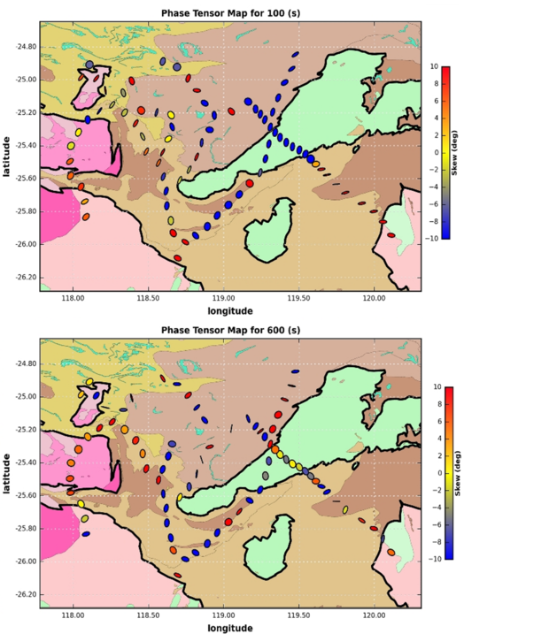
In 2013-2015 135 new broadband MT stations were collected as part of the SIEF Distal Footprints Research Project. These stations covered the Ashburton Basin in the western Capricorn Orogen and the sedimentary basins that form the central and eastern Capricorn Orogen. This survey not only adds to the body of broadband MT data over the orogen it provides further insights into the sub-surface electrical variations of the basin geology and an opportunity to interpret and map the cratonic boundaries and lithospheric faults. The central and eastern Capricorn dataset are unique in that they contain numerous sites with out of quadrant phase data due to strong resistivity contrast and the complex 3D geometries of the faults, and sedimentary basin and craton geology. Studies of local broadband MT data acquired as part of the SIEF Distal Footprints Research Project demonstrate that deformed conductive basin units within the Eastern Capricorn Orogen can be mapped from 3D inversions of this data.
All MT data are now available for download from the Airborne Geophysics Index (MAGIX) layers using the Geological Survey of Western Australia’s (GSWA) interactive map-viewing application GeoVIEW.WA.
Details of the 2011 East Capricorn Orogen MT traverse and its interpretation are available in Report 135 A magnetotelluric traverse across the eastern part of the Capricorn Orogen.

Contact
For more information contact:
geological.survey@dmirs.wa.gov.au
