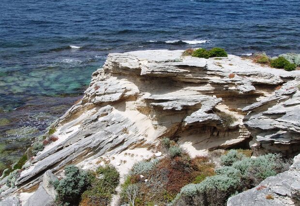
Rottnest Island tells the story of sea-level changes over the past ~140 000 years — when the sea was both higher and lower. At Fairbridge Bluff, ancient corals that grew about 132 000 years ago are exposed well above high tide level, so sea level must have been several metres higher at the time. However, the limestone of which the island is mainly composed formed on an broad, exposed, windswept plain that extended 20 km west of where the island is now. How can these different settings be explained?
Wadjemup / Rottnest island (StoryMap)
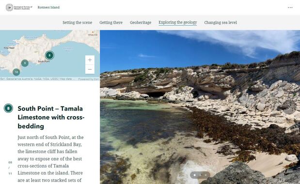
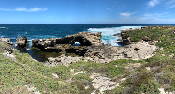
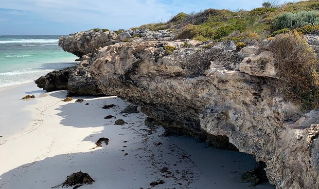
Explore a StoryMap of Rottnest Island’s recent geological history on your computer, tablet or phone. Take a virtual tour of the island, visiting each site in order, or use the interactive map to jump from one locality to the other. Discover how relict, elevated shoreline notches and a fossil coral reef tell of a higher sea level in the past. See the connection between those features and the Tamala Limestone, a relict dunefield formed when sea level was more than 100 m lower, and how they fit with the global sea level curve for the past ~140 000 years.
Rottnest island — a geology guide (app and pamphlet)

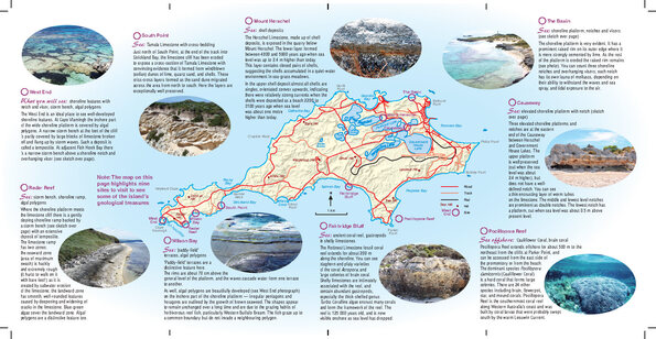
Pop this handy pamphlet in your pocket or bag and discover the surprising variety of geological features as you travel around the island. Stand at the spots where the photos were taken to imagine how the scene must have looked when the rocks were forming the climate and sea level was different from today.
You can also download the Everythere app (from Apple’s AppStore or Google Play) to your phone or tablet. Select Rottnest Island — a geology guide to navigate 12 sites using your mobile device to guide you around the island.
Guidebook to the geology of Rottnest Island
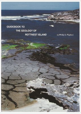
Guidebook to the geology of Rottnest Island is a handy addition to your backpack while visiting the island.
The book is of equal interest to professional geologists, teachers, students and anyone else with an interest in coastal landscapes and environmental change.
What is in the book?
This field guide covers significant geological and historical influences on the island’s development, including:
- geography and physiography
- geology of the Tamala Limestone, Rottnest Limestone and Herschell Limestone
- sea-level changes
- hydrology
Contact
For further information and to provide feedback, contact:
geotourism@dmirs.wa.gov.au