Some 300 million years ago the Kennedy Range area was covered by an ice sheet, and was later inundated by the sea. In the last 20 million years, the region has experienced significant changes in climate. See the evidence for these events in the rocks at Kennedy Range.

What is the book about?

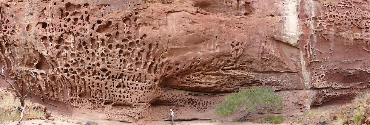
This handy book gives a brief description of the geology and guides the curious geotourist to highlights of the Kennedy Range National Park, located about 830 km north of Perth and about 150 km east of Carnarvon. The National Park covers an area of approximately 1400 km2, with a small portion along the eastern margin readily accessible to visitors in 2WD vehicles. There, the escarpment rises to 100 m above the surrounding plain and is dissected by spectacular gorges with walking trails to rocky pools, seasonal waterfalls, and intricate textures at Honeycomb Gorge.
The Kennedy Range rocky outcrops show evidence of many phases of climatic change — from the 300-million-year-old glaciation to recent warmer and wetter climates when much of the ironstone and the famed mookaite (an ornamental stone found west of the Range) formed. The range began to develop in response to uplift and erosion more than 130 million years ago. Wind and water have sculpted and continue to modify the rocks into remarkable shapes, and the rocky walking trails are strewn with boulders that have tumbled down the sandstone cliffs. It is a rugged and remote place.
How to access the book
To obtain a copy of Geology of the Kennedy Range area by AJ Mory and RM Hocking, download a free PDF from the link below.
Geology of the Kennedy Range area
Contact
For more information contact publications@dmirs.wa.gov.au.
