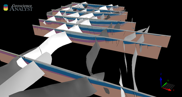
This model was developed as a case history to show the application of Intrepid Geophysics’ data processing software Intrepid combined with the geological and geophysical modelling package GeoModeller. The aims were to: 1) build a 3D geological model that honours the observed magnetic and gravity data available; 2) perform a joint magnetics–gravity–lithotectonically constrained stochastic inversion, for the purpose of optimising geology geometry and rock properties.
Construction of the model initially included multiscale edge detection (worms) and depth-to-basement estimation, using algorithms within the Intrepid software. Surface information included structural interpretation, and magnetics and gravity interpretation, to infer basin architecture. Some constraints were provided by drillholes, interpreted geological cross-sections, and seismic interpretations.
For further information contact:
3D.geoscience@dmirs.wa.gov.au
