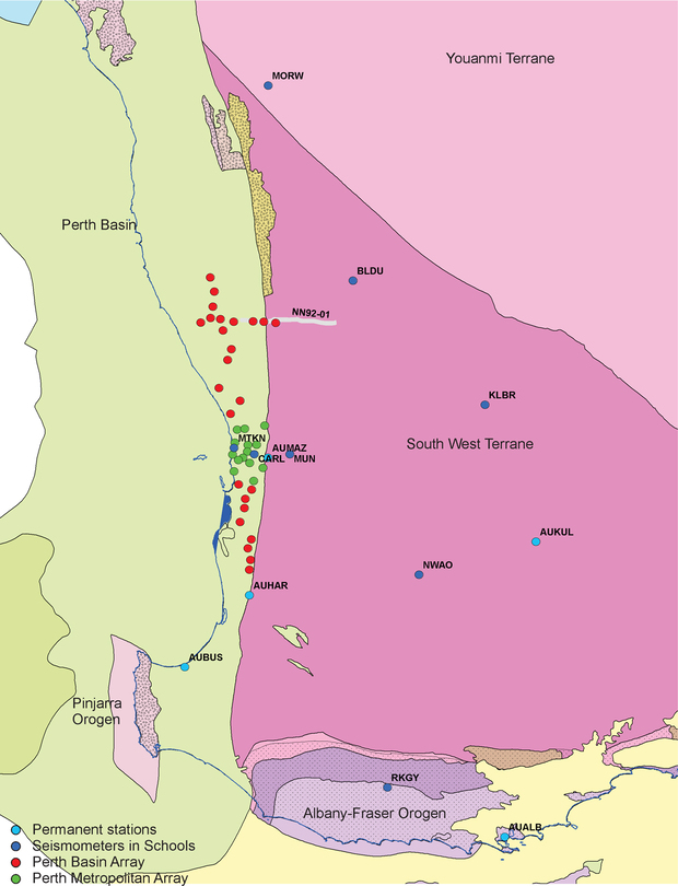
A passive seismic experiment was conducted during 2017 in the onshore Perth Basin. Data from a total of 29 stations were acquired. The array comprised a north–south transect from near Moora to near Harvey, with a shorter east–west transect near Moora which extends on to the adjacent Yilgarn Craton. Additional data were also acquired in the Perth metropolitan area.
Data analysis using common conversion point stacking of teleseismic arrivals and ambient noise tomographic methods allows mapping of crustal velocity structures at regional scale. In general, signal-to-noise levels were poor, largely due to shorter than expected deployment times. This resulted in poor resolution of the geology at deep levels; for example, the Moho is poorly imaged and it is unclear whether it is represented by a velocity transition zone rather than a sharp discontinuity. The Perth Basin thickness is estimated at around 10 km, consistent with previous assessments based on interpretation of seismic reflection data (GSWA Report 184 Regional seismic interpretation and structure of the southern Perth Basin). Beneath the Basin, the crust has a largely consistent shear wave velocity structure with laterally continuous zones.
This project is a collaboration with the Australian Research Council’s Centre of Excellence for Core to Crust Fluid Systems in Centre of Exploration Targeting at The University of Western Australia.
Contact
For further information contact:
geological.survey@dmirs.wa.gov.au
