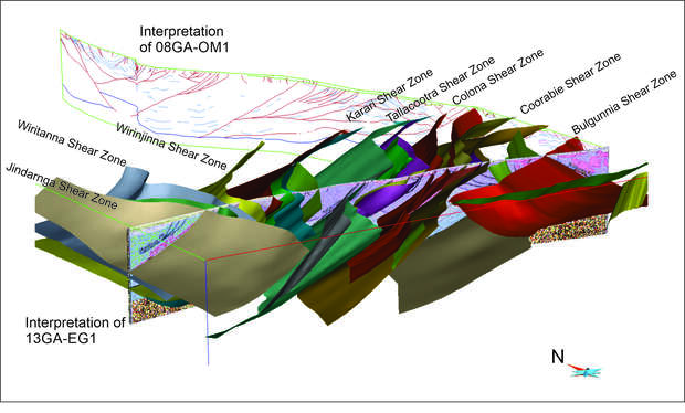
The acquisition and interpretation of the deep crustal seismic line 13GA-EG1 allowed a 3D model to be constructed for the western Gawler Craton. The 3D model expands on the Eastern Gawler IOGC / Woomera Prohibited Area model, which sits to the north and east of this seismic line. As the Eastern Gawler IOCG / Woomera Prohibited Area model was created prior to interpretation of seismic line 13GA-EG1, some features conflicted with the more recent seismic interpretation. Two-dimensional forward modelling in the western Gawler Craton has revealed crustal-scale structures that can be represented well with geophysical modelling techniques, and provide greater 3D constraint in the form of a crustal architecture model.
The new model runs from the approximate western boundary of the western Gawler Craton at the Jindarnga Shear Zone eastwards to the start of the north–south 08GA-OM1 seismic line at Tarcoola. In the north–south dimension the model runs ~100km to the north and south of 13GA-EG1.
Differences in physical properties clearly show the difference in lithologies and metamorphic/intrusive histories of upper crustal domains overlying the Western Gawler Seismic Province compared to either of those overlying the Central Gawler Seismic Province or the Coompana Province. However, similarities between blocks within each domain support the current domain definitions. Only in the Wirinjinna and Karari seismic subdomains do internal differences still leave unanswered questions and reflect the sparsity of geological constraint within these regions.
For further information contact:
3D.geoscience@dmirs.wa.gov.au
