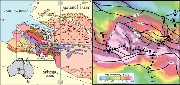
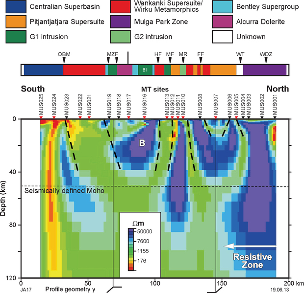
The Musgrave Province is host to several significant mineral deposits, including Ni–Cu–PGE (e.g. Nebo-Babel) and nickeliferous laterites, orogenic and intrusive gold, and potentially iron oxide–copper–gold deposits. Magnetotelluric (MT) surveys were conducted to determine the crustal structure of the region, with particular focus on identifying the geometry of large-scale faults and shear zones that may be prospective for mineralisation.
MT data were collected along two orthogonal profiles, each approximately 150 km long, across the West Musgrave Province. These profiles show that the region is dominated by resistive lithosphere with several more conductive zones identified within, several of which relate to the projected position of deep-penetrating faults which are potential pathways for mineralising fluids. 2D gravity and magnetic forward models provided a broad overview of the crustal structure and were used to investigate links between the structures revealed in the MT data. These results were combined to construct a 3D model which was tested using petrophysical constraints for geophysical inversions in order to investigate the plausibility of the model and other alternatives.
The results show that the west Musgrave Province is dominated by structures related to the 1085–1040 Ma Giles Event and the 600–520 Ma Petermann Orogeny.
Details of the model/project can be found in GSWA Report 114 Imaging crustal structure in the west Musgrave Province from magnetotelluric and potential field data.


Contact
For further information contact:
geological.survey@dmirs.wa.gov.au
