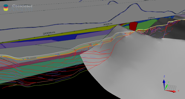
This 2020 release comprises the 3D geological model of the Yilgarn Craton – Officer Basin – Musgrave Province (YOM) seismic line as GOCAD voxets and surfaces. The YOM 3D geological model was built by Geoscience Australia (GA) to highlight the broad-scale crustal architecture of the region and extends to a depth of 60 km to incorporate the Mohorovicic discontinuity (Moho). Full details of the procedure followed to build the model can be found in Goodwin et al. (2013) within GA Record 2013/28.
The YOM seismic line acquired deep crustal seismic data along 484 km running from the Yamarna Terrane in the far eastern Yilgarn Craton, across the Officer Basin and into the Musgrave Province. The objectives of the seismic line were to:
- produce high-quality seismic images across the western Officer Basin, one of Australia’s underexplored sedimentary basins
- investigate the architecture of the Archean Yamarna Terrane in the far northeast of the Yilgarn Craton
- investigate the deep structure of the Mesoproterozoic west Musgrave Province
- investigate the relationship between the Yilgarn Craton and the west Musgrave Province beneath the western Officer Basin.
The seismic line was complemented by gravity and magnetotelluric (MT) surveys, as well as extensive geological mapping.
The aim of the model was to compile all the available data for the YOM region into a 3D space so that a series of volumes representing the 3D architecture could be produced. These volumes were constrained by solid geology at the surface, and at depth by the interpretation of the 11GA-YO1 seismic line and forward models of gravity.
This model was originally built by GA in 2013 and released through the GA website. The model was recompiled in 2020 by the Geological Survey of Western Australia for viewing in Geoscience ANALYST.
For further information contact:
3D.geoscience@dmirs.wa.gov.au
