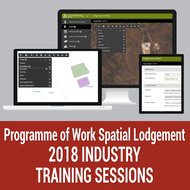
The Department of Mines, Industry Regulation and Safety (DMIRS) introduced spatial lodgement for Programme of Work (PoW) applications in 2017.
| Date: | Monday, 22 January 2018 |
|---|
The Department of Mines, Industry Regulation and Safety (DMIRS) introduced spatial lodgement for Programme of Work (PoW) applications in 2017.
The new PoW-Spatial system runs in parallel with the current lodgement process and will become mandatory later in 2018 for all Programme of Work exploration applications. Programme of Work prospecting (PoW-P) applications will continue to be accepted in hard copy or online through DMIRS Submissions.
PoW applications continue to be accessed through the current EARS Online platform, however during log-in the applicant will have the option of applying for a PoW-Spatial or a PoW-Exploration (existing form).
The updated map-based application will allow users to enter their proposed activities, either by loading spatial files or creating files on screen. The system will conduct automatic checks by intersecting the proposed activities with other data layers of environmental and cultural significance and alerting the user of the results.
DMIRS also enhanced the system’s functionality last year in response to industry feedback. It now has the ability to upload MapInfo TAB files, has improved spatial validation and error messages, and has the ability to delete all activities associated with an uploaded file. The changes extended the supported upload file formats to include ESRI Shapefiles and MapInfo TAB files.
Training will be available in January, February and March 2018 and will be conducted in computer equipped training rooms, capped at 15 attendees per session. Dates and locations are provided.
Email PoWSpatial@dmirs.wa.gov.au for further information or to register for your preferred training session.

