TENGRAPH Web will offer new features and seamless coverage
| Date: | Tuesday, 18 April 2017 |
|---|
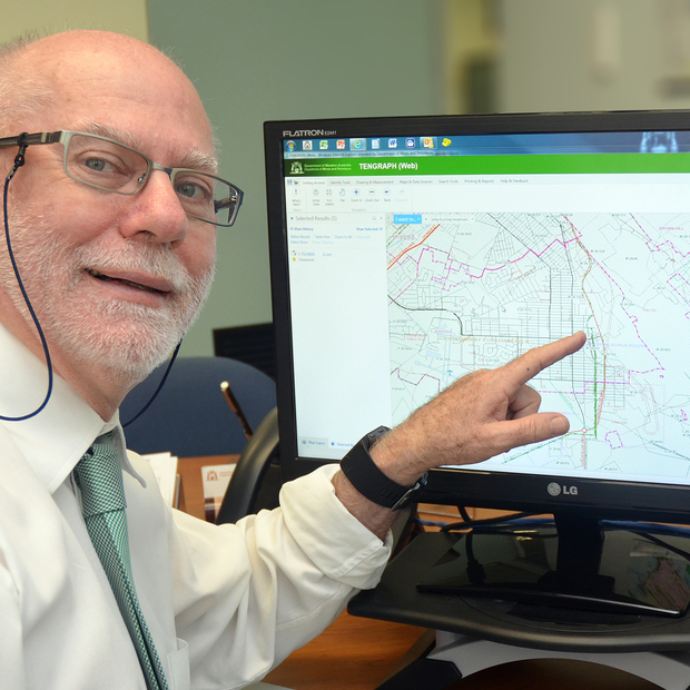
The Department of Mines and Petroleum is testing a new online version of its highly popular TENGRAPH mapping system that is planned to be rolled out in the coming months.

The Department of Mines and Petroleum is testing a new online version of its highly popular TENGRAPH mapping system that will be rolled out in the coming months.
TENGRAPH displays the position of Western Australian mining tenements and petroleum titles, giving an accurate picture of land under mining activity, and is used to determine ground available for mineral exploration.
“TENGRAPH has been a valuable and reliable resource for explorers since 1992 when it first functioned as a mainframe system, but it is showing its age and has links to technology that is no longer supported,” DMP Mineral Titles Executive Director Dr Ivor Roberts said.
“TENGRAPH has served the department well over the years and we have had a great return on our investment, but it does not provide the seamless coverage of the entire State that the new browser-based system does.
“It also doesn’t provide image data and all the other bells and whistles that the new system offers.”
Dr Roberts said that the new TENGRAPH Web is a more business oriented system with a strong focus on tenements, approvals and increased functionality.
“It is streets ahead of the old system, but it will not be a totally new experience for people using DMP’s interactive geological mapping system, GeoVIEW.WA, because there are commonalities with the TENGRAPH Web interface,” he said.
Dr Roberts said that high quality maps can be produced with TENGRAPH Web.
It has a new interface that uses the same pan and zoom mouse commands as Google Maps and it has the ability for users to include overlays of geology and topography.”
Dr Roberts said that the new system would operate in tandem with the old TENGRAPH so that people had the ability to use either system until they were comfortable with TENGRAPH Web.
“Usage will be monitored and we expect most people to migrate to the new system within about a month of the roll out, but we will continue to provide access to the old TENGRAPH until everyone is happy,” he said.
“We are gathering feedback from selected external users during the testing period and will continue to seek feedback from all users after the new system is rolled out.”
DMP invites users to take part in testing
DMP is inviting all TENGRAPH Online users to express interest in gaining early access to the new TENGRAPH Web system by completing this survey by 2 May.
The offer is open to all current users, but the number of spaces is being limited initially to 100 with more users being added progressively over time.
Users who have been granted access will be informed by email with a special link to the new system. We may need to temporarily suspend access for technical reasons, or to allow other users access.
Fact file:
- TENGRAPH Web also provides links to other DMP systems including:
- Mineral Titles Online
- Petroleum and Geothermal Register (PGR)
- WAMEX (mining tenement open file exploration reports)
- MINEDEX (mine site and mineral deposit information)
- TENGRAPH Online has about 12,000 registered users.
- Being solely web-based, users will access TENGRAPH Web directly through DMP’s servers, rather through a separate (CITRIX) platform.
- The new interface uses the same pan and zoom mouse commands as Google Maps and GeoVIEW.WA.
- The new system retains all existing TENGRAPH features such as links to Google Earth, Mineral Titles Online, WAMEX, MINEDEX and PGR, plotting tools and custom colouring objects.
- Layers are easier to turn on and off.
- High quality maps can be printed from the new system.
- Geology and topography overlays are included.
- Transparency slider bars can be used to change the visibility on the map.
- Users can save results from searches and selections to a CSV file or shapefile (geospatial vector data format) for use in other Geographic Information Systems (GIS).
- Users can add shapefiles by dragging a file directly onto the map display.
- Landgate aerial photography can be displayed.
- Users have easy access to scanned historical tenement maps.
- TENGRAPH Web will benefit external users through:
- Improved access to DMP spatial and non-spatial information.
- Better service delivery delivered by enhanced functionality.
- Improved appraisal processes integrated with eLodgement.
- Ability to rapidly respond to industry or legislative change because TENGRAPH Web is consistent with the department’s spatial data infrastructure.

