A shift to greater accuracy: Geocentric Datum of Australia datum upgrade GDA94 - GDA2020
| Date: | Thursday, 01 September 2016 |
|---|
In 15 million years, the Australian continental tectonic plate will have travelled about 1,000 kilometres to the north.
That might seem a very long time away, but Australia is moving north-east by about seven centimetres each year, colliding with the Pacific Plate, which is moving west about 11cm each year.
Because of moving tectonic plates, the location of geospatial coordinates changes over time and to correct for this, adjustments are required to the Australian datum.
The Western Australian mining and petroleum title registers comprise both a textual description and a spatial representation for all tenements throughout Western Australia.
The description for exploration licences is a geographical coordinate set comprising latitude and longitude intersections using the GDA94 datum.
However, because the Australian tectonic plate is moving, adjustments are required to the Australian datum to maintain ground accuracy.
Rather than a continuous change, changes are made at certain agreed times.
Previously, a change of about 200 metres occurred in the year 2000 when Australia shifted from the Australian Geodetic Datum 1984 (AGD84) to the Australian Geocentric Datum 1994 (GDA94).
A new shift of about two metres is being planned for introduction in 2017, with the datum based on position estimates in 2020.
This new datum is known as GDA2020 and the difference between the current GDA94 and new datum is much smaller than last time - only about 1.8 metres.
The Department of Mines and Petroleum (DMP) has begun preparing for the introduction of the new GDA2020 spatial datum.
Given the relatively small shift for the new datum, and looking to the future where location precision and accuracy are becoming ever more important, DMP will investigate whether a similar approach to the datum shift as made in the past is appropriate to repeat, or if there is a better way.
The GDA2020 datum shift will affect many tenements, particularly those described by the 1’x1’ or 5’x5’ latitude/longitude grid system (exploration licences).
The department’s top priorities are managing the update smoothly and maintaining certainty of tenure for all tenement holders.
DMP will soon be seeking input from stakeholders about the datum upgrade and the options being considered to manage it, and will continue to keep stakeholders informed at key stages as the project progresses.
If you would like to read more about datum modernisation, visit the ICSM website.
For more information about DMP’s involvement please email the DMP GDA2020 project team at GDA2020@dmp.wa.gov.au.
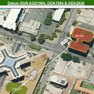
Map showing location of Mineral House in East Perth (AGD84, GDA94, GDA2020)
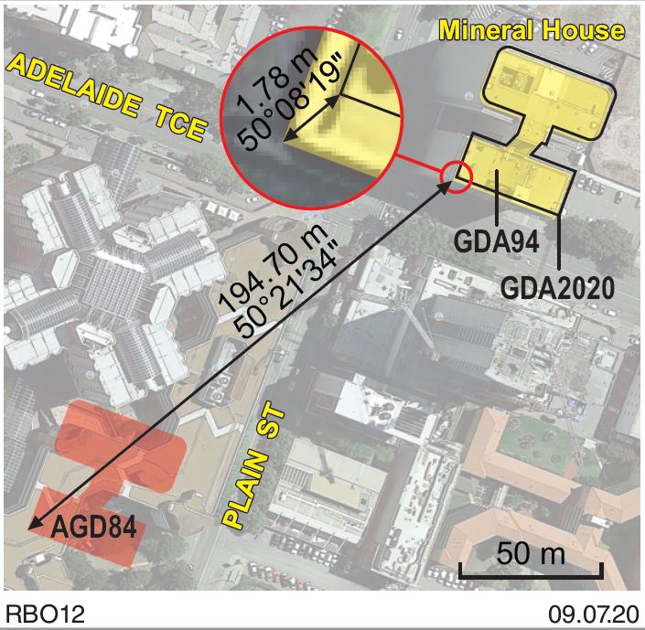
This map shows the location of Mineral House described in using three different datums: AGD84, GDA94 and GDA2020.
Australian Geodetic Datum 1984 (AGD84) was changed to Geodetic Datum of Australia (GDA94) in 2000 and resulted in an approximate 200m shift.
The shift to Geocentric Datum of Australia 2020 (GDA2020) is approximately 1.8m.
The buildings always stay in the same place relative to all other buildings and streets etc. The Datum changes represent the movement of the entire continent, requiring updates to the way the building location is described.