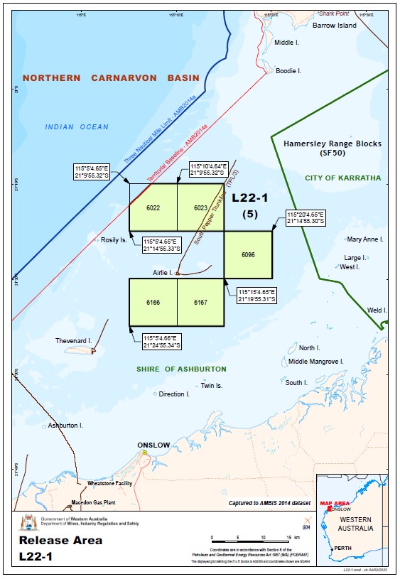
Area Summary
| Block No | Block No | Block No | Block No | Block No |
|---|---|---|---|---|
| 6022 | 6023 | 6096 | 6166 | 6167 |
Contains five (5) blocks to the extent only that the area is within the State as defined in section 26 of the PGERA.
Special Notices
Applicants should be aware of the following special notices in relation to Area L22-1:
I, Kristian Hartley Dawson, Executive Director, Resource Tenure Division of Department Mines, Industry Regulation and Safety, under delegation from the Minister for Mines and Petroleum, advise that it is intended that a condition under section 91B of the Petroleum and Geothermal Energy Resources Act 1967 will apply to any petroleum exploration permit granted in respect of Areas L22-1 prohibiting the holder from entering upon:
- any offshore islands above the mean low water mark as is included in the permit area.
- any Crown Reserves, File Notation Areas, Class A and National Parks, being areas of high environmental conservation value; and
- land within any townsite boundary.
Moratorium on Hydraulic Fracturing
Please be advised, the State Government’s decision to indefinitely extend the moratorium means that hydraulic fracturing cannot be undertaken under any new petroleum exploration permit granted in relation to Discrete Area L22-1 by way of this acreage release process. Furthermore, any subsequent petroleum title deriving from this acreage release process will be prohibited from utilising hydraulic fracturing for exploration or production. For clarity this will include any production licences or retention leases arising out a permit granted from Release 2 of 2022. The continuation of the moratorium has been given effect by way of amendments to the Petroleum and Geothermal Energy Resources (Hydraulic Fracturing) Regulations 2017. These amendments took effect in September 2019.
Environmental considerations
This area contains a number of environmental considerations (such as Threatened Ecological Communities, Environmentally Sensitive Areas, and Red Book Areas) which potential applicants should consider when making an application and planning a work program. Operational activities may require consultation with the Department of Biodiversity, Conservation and Attractions, the Department of Water and Environmental Regulation, and the Department of Agriculture, Water and the Environment (Cth). See map provided.
Available data and maps
Contact
For any general enquiries please contact the Resource Tenure team
Email: petroleum.titles@demirs.wa.gov.au
For data enquiries please contact the Statutory and Resource Information team
Email: petdata@demirs.wa.gov.au