The geology of Shark Bay showcases the geology of this World Heritage Area from living stromatolites to evidence of past mega-tsunamis. It also covers the cultural heritage of the area, from Aboriginal history to details of the wreck of the Zuytdorp in 1712. The book, published in 2014, is the culmination of 50 years’ research by geologist and author, Dr Phillip Playford, and a team of co-authors (AE Cockbain, BF Berry, AP Roberts, PW Haines and BP Brooke).
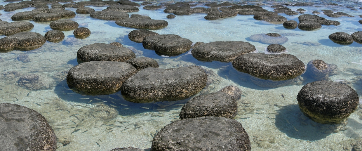
Living stromatolites
The living stromatolites at Shark Bay are world famous. These modern-day analogues of Archean stromatolites are little changed from their predecessors that were first found 3400 million years ago, and flourished about 2800 million years ago. The stromatolites thrive in a placid super-saline environment.
Stromatolites are renowned as the most extensive and diverse organisms of their kind found anywhere on earth. They were first discovered by Dr Playford in 1954 and were largely responsible for Shark Bay being listed as a World Heritage Area.
Mega-tsunamis
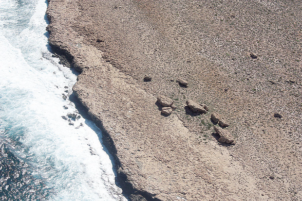
Unusual occurrences of large blocks on top of cliffs overlooking the sea have been interpreted as debris scattered by the force of so-called mega-tsunamis that struck the Western Australian coast up to 5000 years ago.
Several of these deposits have been discovered at Shark Bay, Barrow Island, Legendre Island and along the Kimberley coast. They are thought to be among the largest tsunami deposits on Earth.
For example, in the image on the right, a number of imbricate blocks slope inland, as a result from powerful backwash after the tsunami had reached its highest runup and water was rushing back to the sea.
The wreck of the Zuytdorp
The Zuytdorp Cliffs form another striking feature of the geology of the area. This precipitous line of cliffs — some 200 kilometres long and up to 250 metres high between Shark Bay and Kalbarri — is named after the Dutch East India Company’s ship Zuytdorp, which was wrecked at the base of the cliffs in 1712.
.bmp)
_rdax_620x763s.jpg)
What’s in the book?
The book consists of:
- 300 pages
- 400 full-colour photographs
- world-renowned stromatolites of Hamelin Pool
- mega-tsunamis that have hit the coast
- the magnificent Zuytdorp Cliffs
- the results of thrust faulting along the Hardabut Fault
- Dirk Hartog’s visit
- significant economic commodities of the area
- unique geology of international interest.
How to access the book
To buy a hardcopy of Bulletin 146 The geology of Shark Bay by PE Playford, AE Cockbain, BF Berry, AP Roberts, PW Haines and BP Brooke, please email bookshop@dmirs.wa.gov.au. You can also download a free PDF from the link below.
The geology of Shark Bay