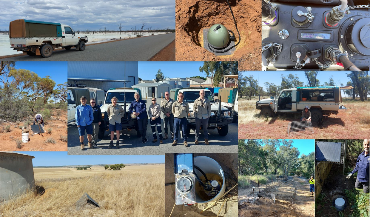
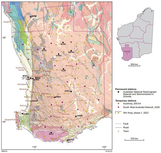
The first phase of WA Array started in November 2022 with the deployment of 128 new passive seismic stations in the southwest of Western Australia. In addition to these, 16 stations from the South West Australia passive seismic Network (SWAN) were serviced and absorbed into the array. The Geological Survey of Western Australia assisted with the installation of the 11 stations from the national AusArray network that are located within the Southwest region and which also fit into the WA Array network. The remaining places in the network are covered by existing stations from the Seismometers in Schools network (three stations) and from the Australian National Seismograph Network (six stations) bringing the final count of stations in phase 1 of WA Array to 161.
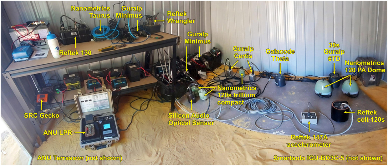
The passive seismic stations include instruments from Reftek, Nanometrics, Guralp, Silicon Audio and GaiaCode, all of which are either 60 s or 120 s broadband. There is also a range of models including Reftek Wranglers and 130 digitisers, ESS Geckos, ANU LPR2000 and Terrasawrs, Nanometrics Taurus and Guralp Minimus.
Data from all stations was retrieved at six months and initial data quality control were started. Obvious problems such as power issues and timing mismatches were addressed in the field at the site visit by adjusting the setup of the station and firmware upgrades.
Station retrieval was completed in December 2023 with all WA Array stations removed back to Perth for checking. All stations recorded continuously at 100 samples per second and remained in the ground for one year.
Calibration test
It is essential that all the different types of seismometers show the same waveform for the same earthquake. Hence we conducted a calibration test to verify that all the combinations of equipment produced an identical trace for the same earthquake. To do this, we ran all combinations of instruments on the same slab concurrently and compared the waveforms.

Calibration test setup where all seismometer–digitiser combinations were run at the same site.
Models derived from the data show high resolution and include:
- a local seismicity catalogue
- Vp and Vs crustal models derived from local earthquakes
- crustal Vs models derived from ambient noise tomography
- Vs30 models and depth to basement
- Moho depths from receiver function analysis
- bulk crustal composition
- mantle anisotropy
- bodywave tomography imaging the lithosphere
- surface wave tomography imaging the lithosphere–asthenosphere boundary
Waveform data and station metadata can be downloaded via the http://auspass.edu.au FDSN server.
Models and supplementary data can be found in MAGIX.
Details on the processing and models from phase 1 will be available in GSWA Report 256 (in preparation).

Contact
For further information contact:

