This project aims to establish long-term baseline seismic monitoring that will characterise the natural earthquake activity and cultural seismic noise (e.g. quarry blasts) within the Canning Basin. This project is carried out in collaboration with Geoscience Australia (GA) and CSIRO with funding from the Gas Industry Social and Environmental Research Alliance (GISERA).

The Canning Basin, in northwest Western Australia, is one of the largest onshore sedimentary basins in Australia. It contains potential opportunities for developing shale and unconventional gas plays and contains significant groundwater resources. Exploration across large parts of the basin have, to date, focused on the prospectivity for oil and gas for which licences for development of facilities have been granted.
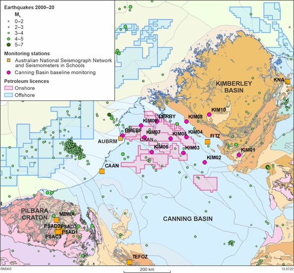
The regional geology and structure of the basin are summarised in numerous publications by the Geological Survey of Western Australia (Zhan, 2020; Dent, 2016; Parra-Garcia et al., 2014; Playford et al., 2009; Mory 2010), but little is known about the natural seismicity of the region. As shown on the map below, the western and northwestern margins of the Australian continent show a moderate amount of long-term seismic activity, with most of the events lying close to the continental margin. Particularly notable is the cluster of earthquakes off the coast of Broome, including the magnitude 6.6 event in 2019 that was felt as far away as Perth. The earthquake loci shown on the map below are generally of a minimum magnitude of 2.5. However, it is known that where there are moderately sized earthquakes, there will also be many smaller earthquakes, but these currently go undetected and unreported.
The origin of the natural seismicity is associated with ongoing deformation along the northeastern margin of the basin; however, the precise location, and low detection rate of seismic activity is poorly constrained due to the lack of earthquake monitoring stations. Currently, only three permanent seismic stations contribute to earthquake monitoring in the region (AUBRM, CAAN and FITZ). Since GA’s Australian National Seismic Network (ANSN) reports events with only magnitudes greater than 2, the reporting rate is artificially low. However, in order to be able to accurately monitor anthropogenic activity a baseline of seismic events as low as magnitude 1.5 will be required.
The scope of this project includes:
- identifying the potential sources of seismic activity using the existing datasets and maps within a desktop study
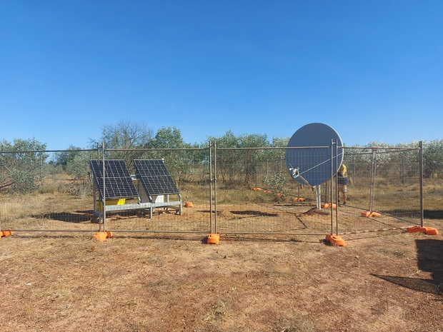
- establishing a local Canning Basin seismic monitoring network sending real-time data into the ANSN
- developing and applying state-of-the-art algorithms for detecting and discriminating smaller, natural, and anthropogenic-induced earthquakes that do not fall into the remit of the ANSN
- developing a platform to publish an earthquake activity catalogue, generating seismicity maps of smaller earthquakes in the Canning Basin, and visualising how these relate to geological features or surface infrastructure
- accumulating knowledge about seismicity trends and their relationship with deep-seated geological structures or near-surface operational activities in the basin
- researching seismological data as appropriate, with the aim of enhancing the geological understanding of the Canning Basin.
So far, data from 12 new stations (see map) are being streamed in real time to Geoscience Australia and incorporated into the ANSN. Data from these stations can be viewed or downloaded from IRIS.


Contact
For further information contact:
geological.survey@dmirs.wa.gov.au
