The Eastern Goldfields Superterrane is a gold and nickel endowed granite–greenstone terrain in the Archean Yilgarn Craton. It is host to the Kalgoorlie ‘Super Pit’ and over 150 operating gold mines. The Eastern Goldfields high-resolution seismic reflection survey was conducted in 2019 to determine the 3D geometry of structures and lithotectonic units of the Kalgoorlie Terrane, with a focus on identifying structures that may be prospective for mineralisation.
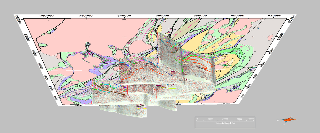
High-resolution seismic reflection data were collected along seven west–east profiles located between Broad Arrow in the north and Kambalda in the south. The multiple profiles provide a understanding of the 3D regional-scale structure of this region of the Eastern Goldfields. The lithotectonic units identified in the survey include a highly reflective, dominantly mafic–ultramafic, lower greenstone succession (Kalgoorlie Group) and a non-reflective, felsic and metasedimentary dominated upper greenstone succession (Black Flag Group). The greenstone successions are intruded by granitic rocks that are typically non-reflective. The middle crust contains highly reflective zones that may be greenstone successions or other units not exposed at the surface. Also imaged are discordant, non-reflective zones interpreted as possible zones of hydrothermal alteration. Most of the major shear zones are east dipping, listric and extend into the middle crust. The structure of the upper crust is dominated by regional-scale, open folds with anticlines typically cored by granites. Most of the structures interpreted in the seismic survey are consistent with structures present in surface maps.
The preliminary interpretation is discussed in an extended abstract from the GSWA Open Day 2020.
Contact
For further information contact:
3D.geoscience@dmirs.wa.gov.au