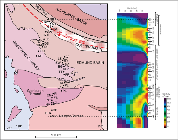
The Gascoyne MT survey aimed to deepen the understanding of the geological history of the Gascoyne region through knowledge of its 3D structure from MT data. The work was completed by University of Adelaide in 2007.
Thirty-eight MT stations were recorded from the Narryer Terrane in the south northwards to the Talga Fault in the Edmund Basin, crossing the Glenburgh Terrane, Gascoyne Province, and Edmund and Colliers Basins. The survey highlighted that the margin between the Yilgarn Craton and the Glenburgh Terrane of the Gascoyne Province appears to dip to the south with the Glenburgh Terrane wedged beneath the northern Yilgarn Craton. This survey showed that the Gascoyne Province and Glenburgh Terrane are distinct in their electrical response and that electrically, the main boundary between the Gascoyne Province and the Pilbara Craton appears to correlate most closely with the Talga Fault. More information about the survey and the results can be found in GSWA Record 2007/16 Magnetotelluric investigation into the electrical structure of the Capricorn Orogen, Western Australia.
Contact
For further information contact:
geological.survey@dmirs.wa.gov.au