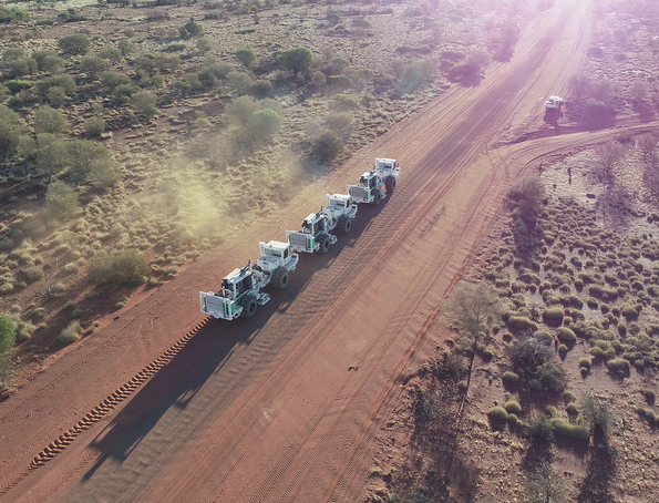
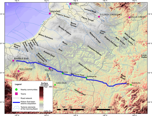
The Kidson Sub-basin deep crustal seismic survey is the longest continuously acquired seismic line in Australia, running 872 km from about 30 km west of the Kiwirrkurra community near the Western Australia / Northern Territory border to about 20 km east of the Marble Bar townsite in the eastern Pilbara.
The Kidson Sub-basin seismic survey was co-funded by the Western Australian Government’s Exploration Incentive Scheme (EIS) and Geoscience Australia’s (GA) Exploring for the Future Initiative. GA operated the survey in 2018.
Prior to the survey, a vast area of the southeastern Canning Basin was very poorly covered by seismic data compared to other parts of the Canning Basin, and consequently was one of the least geologically understood potential hydrocarbon provinces in onshore Australia. The nature of the basement beneath the Basin was also inadequately understood. The main objectives of the survey were to:
- establish the subsurface geology of the Kidson Sub-basin and other components of the southern Canning Basin, including the extent and nature of boundaries of tectonic elements and depocentres
- identify regional faults, folds and other structural features
- image the structure of the basement below and adjacent to the southern Canning Basin, including the extent of major tectonic units such as the Centralian Superbasin, the west Arunta Orogen, the Paterson Orogen and the Pilbara Craton.
Geokinetics Inc. (now SAExploration [Australia] Pty Ltd) was contracted to acquire the seismic data and Velseis Pty Ltd undertook the data processing.
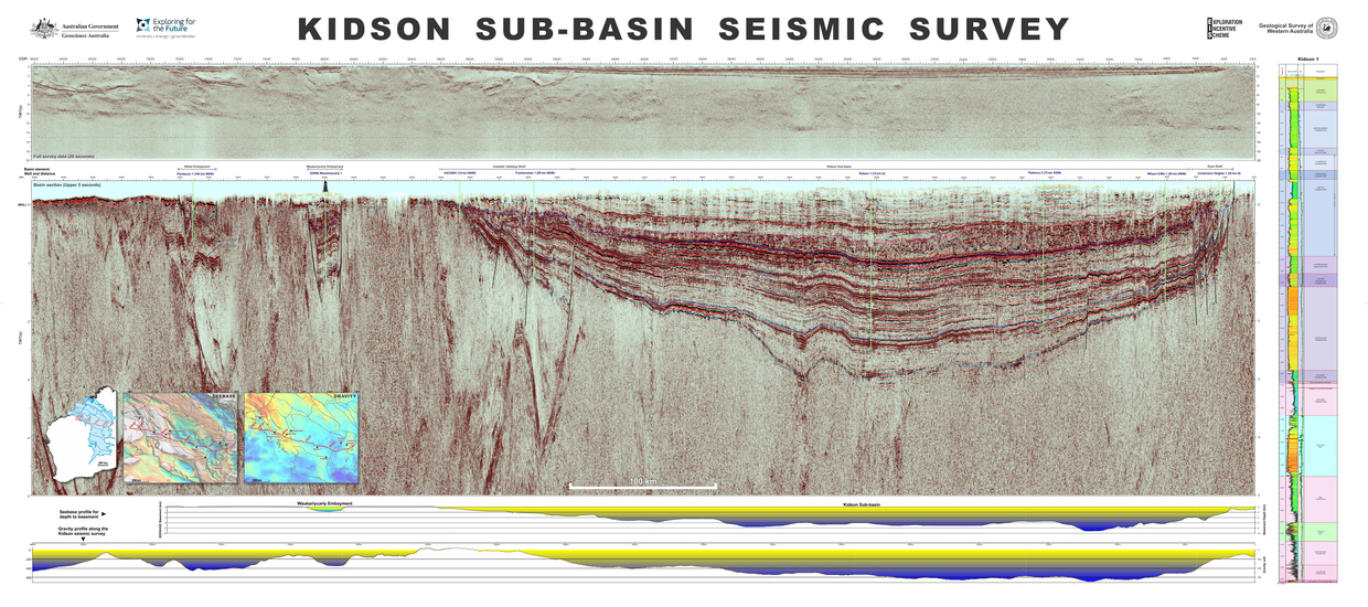
The final survey data is good quality, particularly in the Kidson Sub-basin, showing continuous parallel reflectors across the depocentre and faulting near the Canning Basin margins. Constraints from nearby petroleum exploration well Kidson 1, as well as projections from more distant offset wells including Frankenstein 1, Patience 2, Wilson Cliffs 1 and Contention Heights 1, will shed light on the Paleozoic stratigraphy and depositional history of the southeast Canning Basin during ongoing detailed interpretation.
Data from the Kidson Sub-basin seismic survey are available for download through the Department of Mines, Industry Regulation and Safety’s (DMIRS) petroleum database, WAPIMS, including the seismic report, navigation, SEG-Y in time and depth domains, and velocity profile. An interpretation of the Kidson seismic survey can be found in the Basement interpretation of the Kidson seismic survey 18GA-KB1 plate.
Animation of the seismic reflection profile being shot across the ‘depth to basement’ topography of the Canning Basin
Contact
For further information contact:
basinenergy.geoscience@dmirs.wa.gov.au