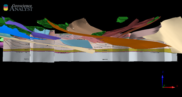
The Murchison 3D, 2019 model covers highly mineralized granite–greenstone domains in the northwestern part of the Yilgarn Craton. The region covered includes the northwestern Youanmi Terrane (Mesoarchean to Neoarchean), the Paleoarchean to Neoarchean Narryer Terrane and their boundaries with the Capricorn Orogen, and the northwestern part of the Neoarchean Eastern Goldfields Superterrane (EGST).
The aim was to provide fundamental constraints on the first-order, 3D geometrical architecture of the network of faults in the region. For the purpose of 3D structural modelling, we use the term ‘fault’ to describe an inferred or interpreted surface of structural discontinuity along which stratigraphic units are offset. It should be noted that the use of ‘fault’ in this context does not entail a characterization of deformation behaviour, and therefore does not imply that faults shown in the models have operated in the brittle regime. Most of the faults in the model are actually ductile shear zones, because the rocks that are currently exposed indicate deformation associated with low- to medium-temperature metamorphic conditions. Under these conditions, crystal-plastic deformation processes are a more common response to tectonic stresses than the formation and propagation of fractures. However, the use of fault surfaces instead of shear zone volumes has been deliberate as the variation of thickness of the shear zones is either unknown (when interpreted) or may not be resolvable in a meaningful way on the scale of the model.
The interpretations presented here are based on integrating the 10GA-YU deep reflection seismic surveys that were acquired in 2010 and 2011 (GSWA Record 2013/6) with aerial magnetic surveys, ground gravity surveys and the mapping campaigns of Geological Survey of Western Australia staff within that region. The seismic lines themselves are not a definitive interpretation, but the best result considering the resources available. Hence, this model contains many uncertainties, and there are even fewer constraints away from the seismic lines.
For further information contact:
3D.geoscience@dmirs.wa.gov.au
