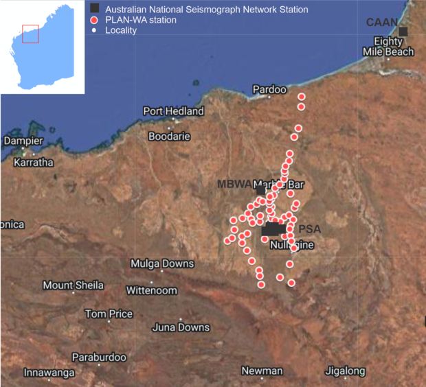
This project utilises a 63-station dense broadband array (PLAN-WA) to investigate the crustal and lithospheric structure of the East Pilbara Terrane. It is a collaborative project run by The University Western Australia (UWA), Macquarie University (MQ), the Geological Survey of Western Australia (GSWA) and the Institute of Geology and Geophysics at the Chinese Academy of Sciences (IGG-CAS). Seismometers were deployed in 2021 and will run until March 2023.
The East Pilbara Terrane is the best-preserved example of Earth’s first stable continents. Characterized at the surface by the granitic domes and surrounding greenstone keels, this is the ideal natural laboratory to study the origin of Earth’s continental lithosphere. The goal is to understand the velocity structure and composition of the crust, and to reveal any lithospheric fabric that may help understand the tectonic processes that operated on the early Earth. The survey will also bridge the resolution gap between the known surface structures and those that penetrate into the deep crust, providing information on regional-scale mineral systems that may have been responsible for the deposition of ore bodies at the surface.
Contact
For further information contact:
geological.survey@dmirs.wa.gov.au