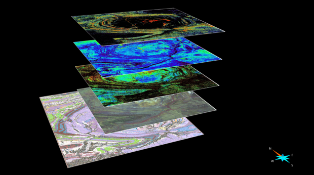
Geological map, false colour image, and ASTER images from the Rocklea model
The Rocklea Inlier 3D Mineral Mapping project was conducted by the Western Australian Centre of Excellence for 3D Mineral Mapping at CSIRO from 2009 to 2012 to showcase the opportunities offered by existing hyperspectral remote and proximal sensing technologies for comprehensive minerals systems analyses.
Key achievements of the Rocklea Inlier 3D Mineral Mapping project are:
- Quantification of iron oxide phases and associated mineralogy derived from hyperspectral data and validated using X-ray diffractometry and geochemistry
- Iron (oxyhydr-)oxide content: root mean square error of 9.1 wt % Fe
- Al clay content: RMSE 3.9 wt % Al2O3
- Hematite/goethite ratio: RMSE 9.0 wt % goethite
- Spatial characterisation of vitreous vs ochreus goethite
- Defining the Cenozoic channel boundary using key mineralogical parameters, such as the kaolin crystallinity
- Modelling the iron ore resource of the Rocklea Inlier channel iron deposits (CID)
- Identification of drillholes that were sunk into barren (i.e. bedrock) lithologies, suggesting that about a third of drillholes could have been saved.
- Detailed characterisation of clay mineralogy that is associated with distinct domains of the CID and its cover (i.e. kaolin group vs Al-smectites vs Fe-smectites).
- Characterisation of mineral assemblages in the Quaternary cover of the Cenozoic channel (e.g. calcrete)
- Improvement of quality of mineral maps by application of vegetation unmixing methods.
All of the points listed above showcase how hyperspectral data can be used for the whole of mine life cycle, from exploration to resource characterisation and are included in the model.
More information can be found at Rocklea Dome (csiro.au).
For further information contact:
3D.geoscience@dmirs.wa.gov.au
