Collaborative program between CSIRO, DMP, UWA and four onshore gas explorers
| Date: | Wednesday, 12 July 2017 |
|---|
The outcomes of a recent study has reinforced that petroleum exploration activities conducted in Western Australia are consistent with regulatory requirements and industry best practice.

The program was conducted in collaboration with Commonwealth Scientific and Industrial Research Organisation (CSIRO), the Department of Mines and Petroleum (DMP) and the University of WA (UWA).
Four onshore gas explorers – Latent Petroleum, AWE Limited, Origin Energy and Norwest Energy – were also involved in the research program.
The coordinated research program looked into methods of establishing baseline values of environmental indicators for the development of onshore gas resources.
DMP Executive Director Petroleum Jeff Haworth said the program considered monitoring aspects in three environmental domains.
“The research looked at shallow sub surface, surface and near-surface atmosphere in the region between Gingin and Dongara north of Perth, which form part of the northern Perth Basin geological area,” he said.
“The studies, conducted during 2015 and 2016, included atmospheric methane measurements, soil gas (methane) flux around the Warro gasfield, and an assessment of groundwater levels and chemistry of the key aquifers.
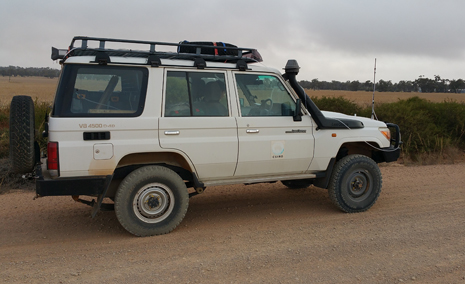
“The atmospheric methane surveys that covered approximately 2,300km, found that the majority of the methane data across the area lie close to the mean value of 1.77 parts per million (ppm).
“This is similar to the methane levels from the latest greenhouse gas data from one of the cleanest air sources in the world at Cape Grim in Tasmania available at http://www.csiro.au/greenhouse-gases/.
“Higher concentrations of atmospheric methane (up to 4.5 ppm) were measured downwind of the Dongara Processing Facility (DPF).”
According to the CSIRO, the measurements were taken early in the morning, before the wind had risen, and the source has not been identified and may be due to higher density methane settling overnight.
The measurements were repeated in the afternoon and methane concentrations had returned to background levels.
“DMP is aware that the facility has been mostly on temporary shut-in status after these measurements were taken and is planned to be put on care and maintenance this year,” Mr Haworth said.
Atmospheric methane measurements taken around well sites were consistent with the low background levels, while atmospheric methane concentrations recorded across the region were too low to carry out any isotopic analysis to investigate the sources of methane.
Soil gas (methane) flux surveys were carried out at 40 sites around the Warro gasfield, which included sites near wells that were hydraulically stimulated, as well as some ‘control’ sites at a distance from the field for comparison.
Two sets of surveys were conducted at the Warro field, neither of which detected any anomalous methane flux at the sites. Future surveys may include a larger area across the northern Perth Basin.
The study reviewed the hydrogeology of the area and found that there is a good interpretation of groundwater flow at a regional scale, as described in a recent bulletin on the northern Perth Basin groundwater by the Department of Water and Environmental Regulation (DWER).
However, the CSIRO study found that there was insufficient data for establishing baseline conditions of groundwater quality on a regional scale.
DMIRS is continuing to work with oil and gas companies for them to adopt the groundwater monitoring guidelines that were developed jointly by DMIRS and DWER.
There are several recommendations from this research which include:
- improvements to the groundwater monitoring coverage in the Yarragadee and Leederville-Parmelia aquifers
- further studies on impacts of the different sources such as facilities, towns, lakes, petroleum wells and cattle on the atmospheric methane concentrations
- modelling atmospheric methane on a landscape scale at selected locations to investigate the sources of ambient methane
- long-term monitoring of soil gas flux rates to understand seasonal variations.
In most cases the data gathered in the CSIRO study represents a ‘snapshot’ of methane distribution across the area at the time of the data collection.
CSIRO believes this study is significant as it is the first to gather ambient concentration values of methane in the near-surface.

