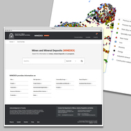
New interface will improve compatibility with tablets and mobile devices.
| Date: | Friday, 23 August 2019 |
|---|
MINEDEX is getting a makeover.
The DMIRS spatial and textual database provides comprehensive data on more than 42,500 mining and exploration sites plus 6,000 projects in Western Australia.
The database’s unique site and project codes are also used to reference communication between industry and DMIRS relating to exploration and mining activities.
MINEDEX is maintained by the department’s Geological Survey of Western Australia (GSWA) division and is free to use without registration.
The available data on mine and exploration sites includes 24,047 mine sites (2,287 of which are operating), 3,325 deposits with resources, 4,438 mining infrastructure sites and other known mineral occurrences.
Executive Director Geological Survey and Resource Strategy Jeff Haworth said a new MINEDEX user interface is expected to be released in October 2019.
“The new interface will allow comprehensive searching, modernise the user experience, and improve compatibility with tablets and mobile devices.
“The new MINEDEX also conforms to the standards of the Office of Digital Government.”
MINEDEX provides data on:
- Location, development status and geology of mineralised sites
- Commodities
- Project structure, ownership and tenements
- Mineral resource estimates
- Mineral production data
- Environmental registrations
- Mine operators
- Inventory of Abandoned Mine Sites.
Custom reports and bulk downloads of MINEDEX data are also available in multiple file formats. Spatial data from MINEDEX can also be downloaded from the Data and Software Centre in ESRI, Mapinfo, KMZ and CSV formats.
For more information go to MINEDEX or contact minedex@dmirs.wa.gov.au

