Geological Survey of WA releases first 3D geology digital models.
| Date: | Tuesday, 22 December 2015 |
|---|
The first 3D geology digital models created by the Department of Mines and Petroleum’s Geological Survey of Western Australia (GSWA) are now available to the exploration industry and the public.
The two models released by GSWA are of the Windimurra and Sandstone regions in the northern Yilgarn craton.
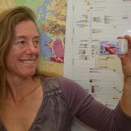
GSWA Senior 3D Geophysicist Dr Ruth Murdie, who has worked on both models, describes the techniques involved in the modelling as “thinking big”.
“The whole point is to look for big structures,” she said. “These models are designed to think big, so that we’re looking at whole mineral systems.
“There are ambiguities along the way, but we make the best educated guess we can to help guide exploration.
“None of us is going to say X marks the spot, but what we can do is use 3D modelling to pick out the big structures so mineral explorers can get a better feel of the geometry of the whole structure to help them target areas for exploration.”
Dr Murdie described GSWA’s 3D Geomodels as the “full works”.
“They include the geophysics, the gravity, the topography, magnetics, etc, so if anyone wants to recreate GSWA’s efforts at interpretation, all the data are there to have a look at.”
The 3D Geomodels also include the full 2D digital data suite of GSWA’s standard digital map packages.
“Applying the same techniques to many other similar rock assemblages could vastly increase exploration success for commodities such as nickel and copper,” GSWA Executive Director Dr Rick Rogerson said.
“Such 3D models of the structure on the Earth’s crust can reveal the architecture of a whole mineral system, from the ancient fault zones tapping into the mantle, to mineralised rocks near the surface.”
Windimurra, near Mt Magnet, was the first of a number of large igneous bodies within the craton to be modelled in 3D.
The Windimurra model predicts where rocks prospective for chrome, vanadium and platinum group elements may go deep beneath the earth’s surface.
The Sandstone model, which covers an area with significant gold deposits, explores the deep faults in the northern Yilgarn Craton.
“The two regions GSWA has modelled have known deposits of vanadium, and gold, and the models will enhance future exploration potential for more gold, platinum group elements, nickel, and copper.”
A massive 3D model that spans several mineral areas in the northern Yilgarn Craton is due to be released in 2016.
“Believe me, that’s thinking really big,” Dr Murdie said.
The models can be viewed with the free provided software, Geoscience Analyst, but other widely-used file formats are also available.

