The following wells have undergone high pressure, high volume hydraulic fracture stimulation, often involving multiple stages that fractured different zones. Each stage may only take a few hours to complete the fracturing, but there may be intervals where installing coiled tubing or wireline activity is performed between stages.
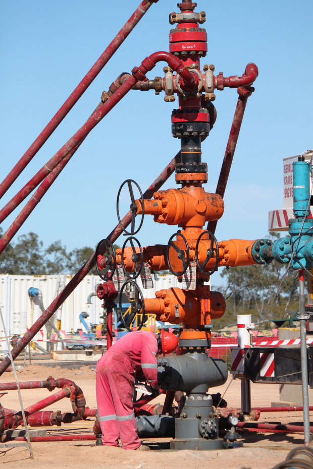
Arrowsmith 2
The Arrowsmith 2 exploration well, located 300 km north of Perth, to the west of the Brand Highway between Eneabba and Dongara in EP 413, was drilled by Norwest Energy NL as a vertical well in 2011 to test the shale gas potential within the region. Previously, the Arrowsmith 1 well, drilled in 1965, flowed gas at 0.11 million cubic metres per day (4 million cubic feet of gas per day) from the Carynginia Formation in the mid-1960s.
Norwest applied to DMP for approval to fracture stimulate Arrowsmith 2 to assess the Carynginia Formation for its shale gas potential. Five zones over four formations (the High Cliff Sandstone, Irwin River Coal Measures, Carynginia Formation and Kockatea Shale) were hydraulically fracture stimulated in 2012. Gas flowed from the tight sands in the High Cliff, the Irwin River Coal Measures and the lower and middle Carynginia shales, culminating with both oil and gas in the Kockatea Shale. The maximum co-mingled flow rate achieved was 99,675 cubic metres per day (3.5 million cubic feet per day).
Testing on Arrowsmith 2 was completed in early 2014 with results indicating that the Carynginia Formation and the Irwin River Coal Measures are potentially suited for development. A 3D seismic acquisition program was conducted in 2015 and the data collected will help Norwest to finalise the optimal target formation and surface location for a horizontal shale gas well on the field.
Asgard 1
Asgard 1 was drilled in 2012 in EP 371 by Buru Energy, to further test the tight gas potential of the Laurel Formation between Fitzroy Crossing and Broome, in the Canning Basin. Buru had previously drilled three wells (Valhalla 1, Valhalla 2, and Valhalla North 1) in the area, with good results.
Asgard 1 was hydraulically fracture stimulated in September 2015. Flowback of this well and of Valhalla North 1 to determine gas flows and appraisal of the resource was conducted in early 2016. Buru sees promising initial results from short-term flowback, with strong returns of fluid and accompanying gas.
Corybas 1
The Corybas 1 exploration well, located 14 kilometres east northeast of Dongara in Production Licence L2, was drilled by Arc Energy APAC Pty Ltd (now owned by AWE Limited) as a vertical well in 2005 and encountered gas in the Irwin River Coal Measures, at a depth of 2414 metres. In 2009, the well was hydraulically fracture stimulated over two intervals. Gas was produced on test. Corybas 1 commenced commercial production in 2010 and is the only tight sand gas well producing in Western Australia.
Senecio 2
The Senecio gasfield is located 15.5 kilometres east of Dongara in production licence L2. Senecio 1 was drilled by ARC Energy (now AWE Ltd) as a sidetrack off the Hakia 2 well in 2005 and intersected a small oil column with a 76 m gross gas column. Senecio 2 was also drilled in 2005, as a sidetrack off Senecio 1. The well flowed at rates up to 28,316 cubic metres per day (1 million cubic feet per day) but declined due to the tight nature of the Dongara Sandstone reservoir.
Senecio 2 was hydraulically fracture stimulated in 2012 over a five metre interval. Following the stimulation program, the well flowed gas at a stabilised rate of 38,228 cubic metres per day (1.35 million cubic feet per day) on test from the Dongara Sandstone.
A third well, Senecio 3, was drilled on the Senecio field in 2014, initially targeting the Dongara Sandstone and Wagina Formation. The well was deepened into the Kingia/High Cliff Sandstone, following the recording of strong gas shows below the Dongara/Wagina Formations, which led to the discovery of the Waitsia gasfield. The combined contingent resource (P50) for Senecio and Waitsia is estimated at 10.2 billion cubic metres (360 billion cubic feet). Senecio 3 is not planned to be hydraulically fracture stimulated because the Kingia Formation is a conventional gas reservoir.
Valhalla North 1
Valhalla North 1 was drilled in EP 371 in the Canning Basin in 2012. The well was hydraulically fracture stimulated in September 2015. Flowback of the wells to determine gas flows and appraisal of the resource was undertaken in early 2016. Buru Energy, who drilled and currently operates the wells, sees promising initial results from short-term flowback, with strong returns of fluid and accompanying gas.
Warro
The Warro 1 and Warro 2 exploration wells were drilled in 1977 by West Australian Petroleum Pty Ltd (WAPET), about 60 km east of Jurien Bay. Warro 1 had significant gas shows but no flow of gas to surface was recorded on any DST tests, even after swabbing and acidising in 1977. Strong gas shows were also recorded in Warro 2. A drill-stem test on the interval 4076 m to 4126 m flowed intermittently at rates up to 2945 cubic metres per day (104 thousand cubic feet per day) after a small fracture treatment. A second drill-stem test on the interval 3991 m to 4073 m flowed intermittently at rates of up to 2265 cubic metres (80 thousand cubic feet per day) after hydraulic fracturing in 1978.
Schlumberger, in 2007, confirmed that modern fracture stimulation techniques should be successful in establishing commercial gas flows from the reservoir section.
Latent Petroleum now operates the Warro field. Latent drilled Warro 3 in 2009; the purpose of the well was to fracture stimulate the Yarragadee Formation. The well was fracture stimulated in 2009. The Warro 4 appraisal well was drilled and fracture stimulated in 2011, while Warro 5 and Warro 6 were drilled in September and October of 2015. Both Warro 5 and 6 were hydraulically fractured in 2015. Latent currently estimates that the Warro field may contain 28-85 billion cubic metres (1-3 trillion cubic feet) of recoverable gas and will require future hydraulic fracturing to bring the gas to surface.
Whicher Range 5
Located 20 km south of Busselton, the Whicher Range field was discovered in 1968 with gas located in the Permian Willespie Formation, at a depth of approximately 4000 metres. The well flowed gas to surface but at non-commercial rates. A total of five wells have been drilled in the field. In 1997, Whicher Range 4 appraisal well was drilled, with significant formation damage resulting from contact with aqueous drilling and stimulation fluids. In 1998, the operator of the field conducted a stimulation program at Whicher Range 4 and Whicher Range 1. Whicher Range 4 had not been effectively cleaned up subsequent to the initial stimulation operations in 1998.
The formation has been regarded as a “tight sand” play, and various types of well stimulation including hydraulic fracturing were used, with no success in releasing commercial quantities of gas until 2004. In 2004 a fracture stimulation operation was conducted on Whicher Range 5 ST2.
In 2011, DMP commissioned research by the Western Australian Energy Alliance (WA:ERA) on the sands of Whicher Range. WA:ERA is a collaboration between the Commonwealth Scientific and Industrial Research Organisation (CSIRO), the University of Western Australia (UWA) and Curtin University of Technology (CUT). The resulting report, Report 112 “Whicher Range Tight Gas Sands Study”, was published in 2012 and concluded that, owing to the type of clay found between the sand grains, hydraulic fracturing would not work in this reservoir. This is because clay swells when it contacts water, thus choking the reservoir pores and preventing the flow of gas. Since this research was released, the current titleholder (CalEnergy Resources Limited) is now looking at developing the field using conventional methods.
Woodada Deep 1
The Woodada gasfield was discovered in 1980, and production commenced in 1982. The area surrounding the field was declared a nature reserve known as Lake Logue Nature Reserve in December 1987. It has produced 1.5 billion cubic metres (52.9 billion cubic feet) of gas from the Beekeeper Formation during its life and is now in care and maintenance.
In 2010, the Woodada 4 well was deepened into Woodada Deep 1 to test the shale gas potential of the Carynginia Formation, which lies below the Beekeeper Formation. In 2012, the well was hydraulically fracture stimulated over two intervals with encouraging results. Commercial flows of gas were not obtained, however, and the well remains shut-in.
Yulleroo 2
The Yulleroo 1 exploration well, located approximately 75 kilometres east of Broome in the Canning Basin, was drilled in 1967 by Gewerkschaft Elwerath. The well flowed gas at a low rate, and the operator used an acid treatment to stimulate gas flow. The well is now decommissioned.
The Yulleroo 2 exploration well is located approximately 2.5 kilometres east of Yulleroo 1. The well was drilled by ARC Energy Limited in EP 391 in 2008 and encountered up to 30 metres of gas sand. Following the demerger of ARC’s Canning Basin assets into a new company, Buru Energy Ltd, the assets were transferred to Buru in August 2008. The reservoir at Yulleroo lies in the Upper and Lower Laurel Formation.
In 2010, Yulleroo 2 was hydraulically fracture stimulated over three intervals in the Laurel Formation and demonstrated the potential of the Laurel Formation as a major unconventional wet gas (condensate) resource. Long term monitoring of this well has shown that there have been no adverse environmental effects on aquifers or any other part of the environment as a result of this operation.
Buru has drilled two more wells on the field, Yulleroo 3 (in 2012) and Yulleroo 4 (in 2013). Yulleroo 3 was suspended after reporting gas sands in the Laurel Formation at approximately 3200 metres. These sands had porosities and permeabilities in the conventional, rather than tight gas range. Yulleroo 4 also had good gas shows.