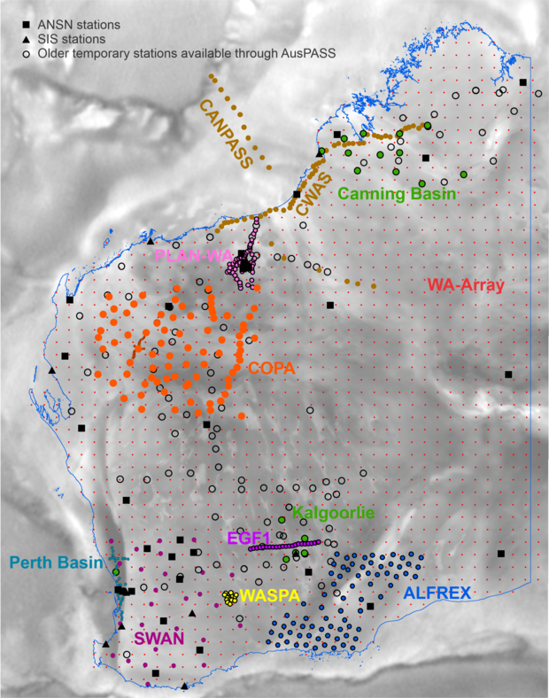
Passive seismic studies utilise the energy generated by earthquakes, both local and global, and events such as storms and ocean waves to image the velocity structure and composition of the Earth. Providing data from shallow levels, through the crust and the lithosphere/asthenosphere boundary to the core, passive seismic surveys help to determine seismic risk and hazard, identify areas of mineral prospectivity, unravel tectonic history and inform land-use planning.
The Australian National Seismograph Network (ANSN) has about 25 permanent seismic stations and one permanent array in Western Australia, which all send real-time data to Geoscience Australia in Canberra.

This network is augmented by the Seismometers in Schools (SIS) program; however, this still leaves areas of the State which are not monitored. Temporary networks are run on a campaign basis with specific objectives in mind. Modern processing methods make use of not only the data from local earthquakes, but data from seismic events from places such as New Zealand and Indonesia. The seismic noise recorded between events is also used to explore the velocity structure of the shallower portions of the Earth.
The Geological Survey of Western Australia is conducting several passive seismic surveys in collaboration with the Centre for Exploration Targeting at The University of Western Australia, The Australian National University, Department of Fire and Emergency Services and the Institute of Geology and Geophysics, Chinese Academy of Sciences.
|
Survey |
DOI / FSDN link |
|
2022 – WA-Array |
|
|
|
|
|
|
|
|
2018 – 19 Eastern Goldfields Array (EGF1) |
|
|
2017 – 19 Canning Basin Array (CWAS) |
|
|
2017 – 18 CANPASS |
|
|
|
|
|
2015 WA Spiral Array (WASPA) |
|
|
2014 – 18 Capricorn Orogen Passive Array (COPA) with High Precision Section |
|
Contact
For further information contact:
geological.survey@dmirs.wa.gov.au
