GSWA’s Webinar Series serves an efficient, inclusive, and interactive way for GSWA to reach a global audience with its world-glass geoscientific data. Wherever you are in the world, you can discover the latest geoscientific research to come out of one of the world’s leading geological surveys. This impactful and versatile method for information dissemination and discussion will form part of how GSWA engages with its stakeholders for many years to come.
Each webinar consists of a presentation and is followed up by a discussion between the host, the presenter, and the audience. Total running time is approximately one hour. These webinars are then uploaded to the GSWA Webinar Series YouTube Playlist.
Attendance is by registration only and announcements are made via LinkedIn, Facebook, and directly to those on our promotional mailing list.
Upcoming webinars
Re-launch coming in early 2024.
Previous webinars
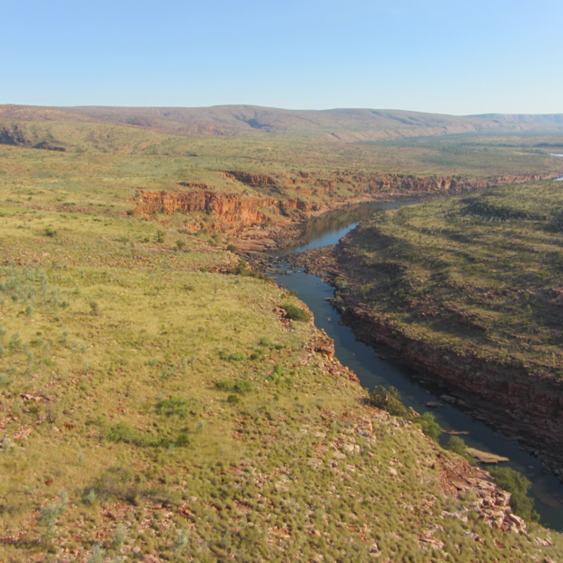
Sedimentology & revised stratigraphy of the Kimberley Basin, WA
Christopher Phillips, Senior Geologist
25 August 2023
Sedimentation at c. 1800 Ma is widespread on the North Australian Craton recording extensional events producing basins filled by fluvial to shallow-marine deposition. In northern Western Australia, the Kimberley Basin is an extensive fluviodeltaic to shallow-marine succession deposited into a broad sag basin on the present-day western margin of the North Australian Craton from <1814 to 1740 Ma. The revised stratigraphy of the Kimberley Basin includes the Speewah, Kimberley, Bastion and Crowhurst Groups. The Moola Bulla Formation is considered a correlative of the lower Speewah Group whereas the Christopher, Red Rock, Revolver Creek and Texas Downs Formations are correlated with the lower Kimberley Group.
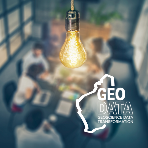
Unlocking potential - GSWA’s world-class geoscience data
Tony Perry, Program Manager, Geoscience Data Transformation Program
23 June 2023
The Geological Survey of Western Australia is custodian of one of the most extensive and respected geoscience datasets in the world. However, a large portion of that data is locked away and hard to access. With increasing interest in the favourable geological environment that Western Australia offers for continued exploration, demands on accessing the value held across geoscience data has continued to grow. Along with advancements in technology and the desire to enable more from artificial intelligence and machine learning, a five year Program is currently underway to aid in the exploitation of additional information from hidden data resources. Join us as we invite you on our journey to unlocking further potential in Western Australia’s geoscience data.
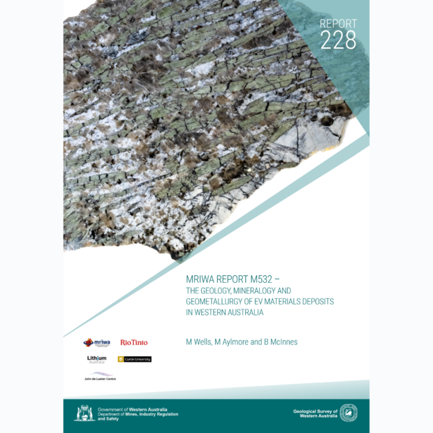
Geology, Mineralogy and Geometallurgy of EV Materials Deposits in WA
Dr Martin Wells, Research Fellow, John de Laeter Centre
12 May 2023
Western Australia currently supplies about 55 percent of world lithium demand. With increasing use in the production of Li-ion batteries (LIBs) to power electric vehicles (EVs), the demand for Li is expected to exceed supply by about 2025. While some research publications are available on individual LCT (Li, Cs, Ta) pegmatite deposits, there is no systematic comparative study of Li pegmatites across Western Australia to date. This worked aimed to develop a geometallurgical framework of Western Australian LCT pegmatites for the purpose of providing fundamental knowledge of lithium orebodies and improve their exploration targeting, mineral processing and chemical refining techniques.
Access the accompanying Report here: https://dmpbookshop.eruditetechnologies.com.au/product/mriwa-report-m532-geology-mineralogy-and-metallurgy-of-ematerial-resources-in-wa.do
Pilbara Craton scientific advances & implications for mineral systems
Yongjun Lu, A/Manager Geochronology & Geochemistry
24 February 2023
The Pilbara Craton in Western Australia is Earth’s best-preserved Archean continental relic and is rich in precious and critical metals. Understanding the evolution of the craton and its ore systems is of great importance for advancing the economy and the transition to green energy. Here we highlight several studies in the region: sanukitoids such as those associated with the giant Hemi discovery; the world’s oldest rift and A-type granites in the Gregory Range; the region’s youngest felsic magmatism–Bridget Suite; the newly defined Proterozoic Percival Lakes Province, and Li fertility of granitic rocks in the Pilbara Craton.
Lauren Grech, Geologist
28 September 2022
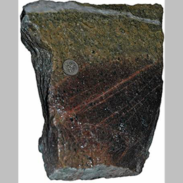
The Gerry Well Greenstone Belt in the Burtville Terrane is a focus for nickel and gold exploration. Knowledge of this area and its prospectivity for nickel and gold systems has been improved with logging geochemical and geochronological analysis of samples from diamond drillcores. Dating of a sanukitoid-like unit that is interpreted to be younger than komatiites has yielded a magmatic crystallization age of 2713 ± 3 Ma, which is older than previously documented (2.68 – 2.66 Ga) sanukitoid events in the EGST, and suggests komatiites in this greenstone belt are older than the c. 2.7 Ga komatiites of the Kalgoorlie Terrane.
Klaus Gessner, Chief Geoscientist
26 August 2022
One of the long-term strategic priorities of the Geological Survey of Western Australia is garnering geoscientific knowledge. This presentation introduces the 2022 GSWA Geoscience Strategy, which defines how GSWA aims to unravel the complex geology of Western Australia and its relation to Earth resources. Our objective is provide trusted advice to the resources industry and to inform government, the scientific community and the public on all matters related to Solid Earth science in Western Australia. To achieve this, GSWA needs to attract, retain and develop highly skilled staff that embrace progress and change, and engage in scientific collaboration.
Nadir De Souza Kovacs, Senior Geologist
5 August 2022
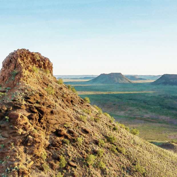
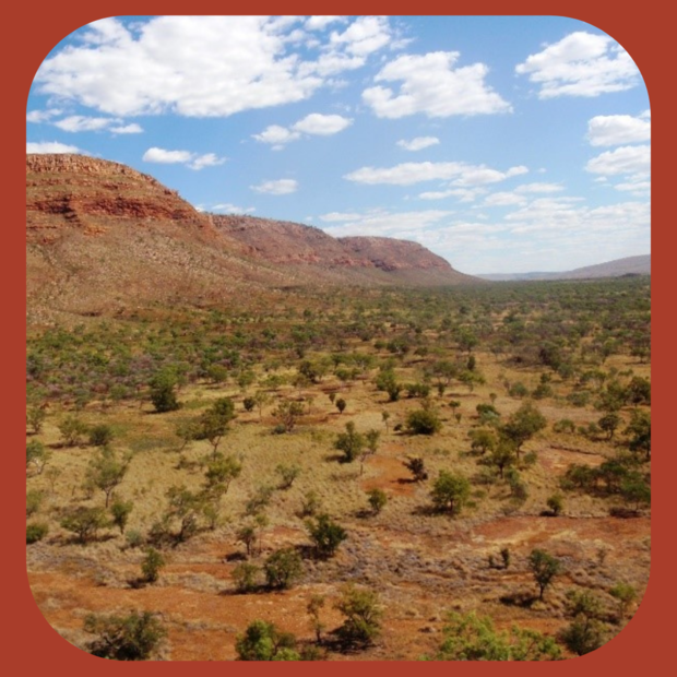
The rugged ancient landscapes of the Kimberley region have been the subject of wonder to the scientific community and to the general public. This webinar will present the west Kimberley Craton landforms, the regolith materials of which they are composed, and discuss the evolution of the Kimberley landscapes. It will present the methodology used to map the regolith surface deposits using geophysics and spectral remote sensing, in particularly the Kimberley ASTER mineral maps created to rectify the effect of green vegetation on the spectral responses.
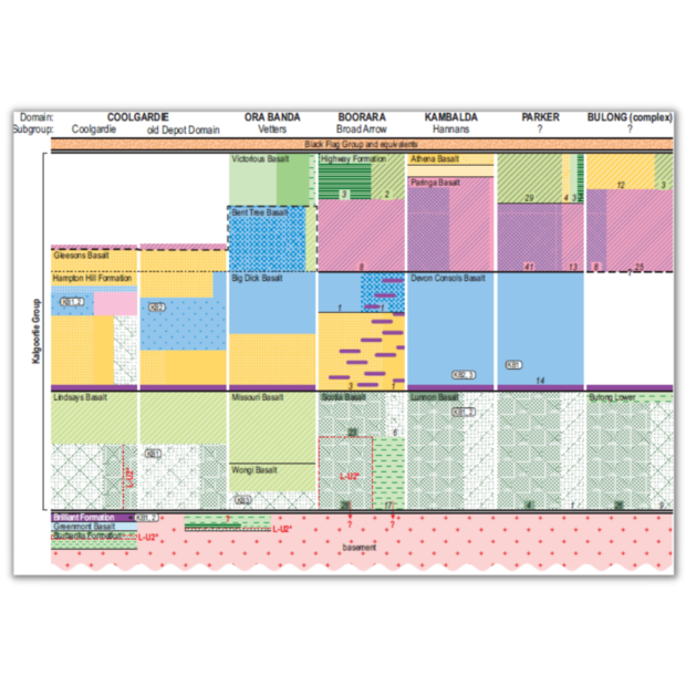
Geochemically barcoding the basaltic stratigraphy of the Kalgoorlie region
Hugh Smithies, Manager Archean Geodynamics
24 June 2022
GSWA’s greenstone geochemical barcode for the Kalgoorlie region of the Eastern Goldfields (Yilgarn Craton) provides a tool that will allow explorers to establish where in the regional or local basaltic stratigraphy geochemical samples with little other geological context are from. Our data show that the basaltic chemostratigraphy follows a common regional evolutionary pattern, but shows complexity in detail that appears to ignore established greenstone domain boundaries. Instead, ‘western’ and ‘eastern’ domain groups are separated along structures (parts of the Zuleika-Abattoir-Bardoc systems in the early stages and the Zuleika at the later stage) that are the surface expression of contrasting lithospheric architecture.
The Cobb Embayment: a new Ordovician succession on the eastern margin of the Canning Basin
Peter Haines, Basins Custodian
27 May 2022
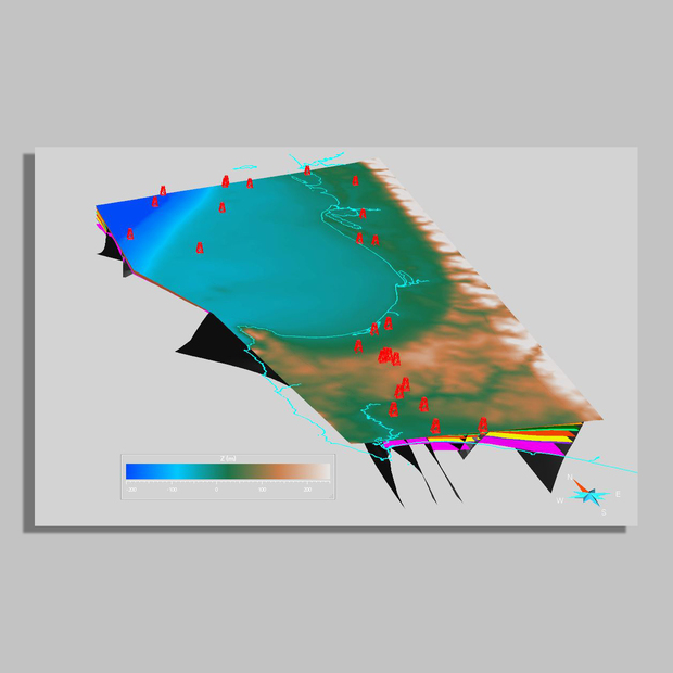
The Cobb Embayment is an elongate 140 x 40 km (4000 km2) component of Canning Basin along its eastern margin. Originally assumed to be filled with Permian glacial rocks, field work by GSWA recently discovered that most of the embayment is filled by an older marginal marine to fluvial siliciclastic succession (the newly defined Cobb Formation) that contains Ordovician fish and trace fossils. The southern margin of the embayment is defined by the Woodroffe Thrust, which was active during deposition, with seismic data suggesting that the wedge-shaped succession is up to 800 m thick near the thrust.
Western Australia’s emerging battery and critical minerals industries
Sarah Sargent, Mineral Investment Specialist
29 April 2022
The emerging economic drivers around ethical supply chains, net zero emissions targets and a low carbon future, present an opportunity for Western Australia to provide a reliable and ethical supply of raw battery and critical materials to the world plus expand our role in the overall value supply chain in mid and downstream processing. This webinar will be an update on what’s driving the demand for WA battery and critical minerals, high level overview of projects plus some of the geoscience work the Survey is doing to support finding more of these minerals.
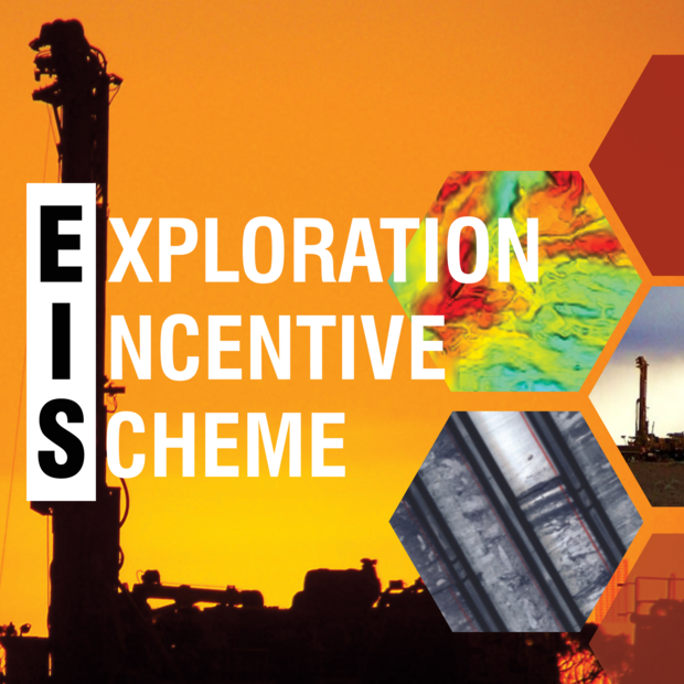
What’s new for exploration in Western Australia? An update on the Exploration Incentive Scheme (EIS)
Louisa Dent, Senior Geologist
25 March 2022
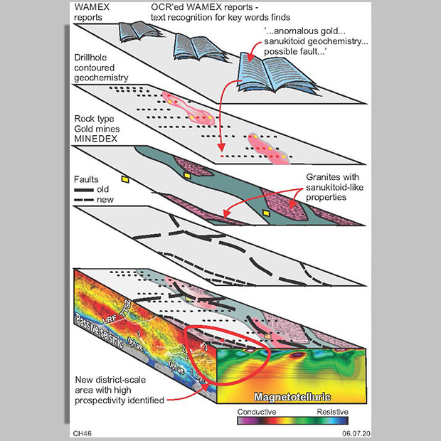
The Exploration Incentive Scheme (EIS) aims to encourage exploration in Western Australia, participating in a range of projects from co-funding explorers to State-wide data collection. From 2019 – 2022 the EIS has received extra, ongoing funding from the WA Government, increased the capped values for its Co-funded Drilling program, and added a brand new Co-funded Energy Analysis program. That’s not all. Airborne Electromagnetic (AEM) data has been collected and released for almost the entire State and an ongoing geochemical barcoding study has revealed close connections between sanukitoids and gold mineralization. The EIS continues to support MinEx CRC National Drilling Initiative and 3D modelling projects. Now, a new set of seismic acquisition and petrophysics projects are gearing up across WA designed to increase our knowledge of the State's crustal architecture.
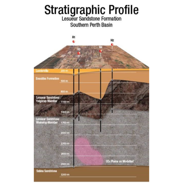
Geology of the South West Hub CCS Research Project, Western Australia
Deidre Brooks, Manager Energy Geoscience
25 February 2022
DMIRS facilitated the SW Hub project to obtain pre-competitive geological and geophysical data to enable major industry to make commercial decisions on Carbon Capture and Storage technology for future projects. The Lesueur Sandstone is the target injection formation and was deposited in the Late Triassic in a fluvial environment. The lower and thickest member of the Lesueur Sandstone is the Wonnerup Member which is over 1500m thick in Harvey 1 and is generally a massive course-grained sandstone with favourable porosity and permeability for CO2 sequestration. Modelling shows that the Lesueur sandstone can store up to 3 million tonnes of CO2 per annum.
Unveiling the cryptic history of the Yilgarn protocraton
Dr Tim Ivanic - Senior Geoscientist
20 January 2022
Since 2013, GSWA mapping and geochronology has started to reveal a distinct chronology of a vast, >750 km long corridor of magmatic activity in the western Youanmi Terrane which, until now, this has been very poorly understood. Not only does this corridor host significant Cu–Zn–Pb, Au and Fe deposits, but the magmatism is >100 million years older than much of what has been mapped further northeast. Through detailed stratigraphic and isotopic data compilations, we propose that 100 Ma of magmatism formed a coherent Yilgarn protocraton by 2.9 Ga, which had significant influences on the craton’s future development.
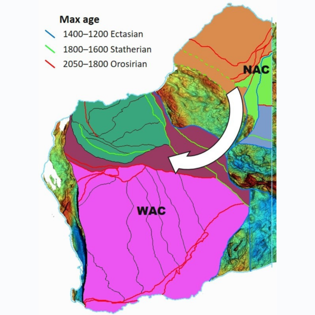
When WAC got in the SAC with NAC, did zircon leave fingerprints?
Dr David Martin - Manager State Geoscience
17 December 2021
The timing of final assembly of Proterozoic Australia is an ongoing enigma that is intensely debated. Previous studies have relied almost exclusively on interpretations of the tectonic setting of magmatic rocks, and the age and style of metamorphic events, to determine this timing. This webinar investigates that timing by examining the detrital zircon record of Paleoproterozoic to Mesoproterozoic sedimentary basins potentially formed in response the assembly of Proterozoic Australia. This work in progress also explores the potential to apply novel zircon fingerprinting techniques that rely on fundamental isotopic differences between the cratonic source areas.
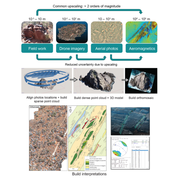
Drone-assisted outcrop 3D photogrammetry modelling and applications at GSWA
Raphael Quentin de Gromard - Senior Geologist
26 November 2021
Drone-assisted photogrammetry modelling of outcrops offers a high-resolution representation of geological features at a scale not accessible from other datasets. This allows to observe geological features often too large to be fully grasped by the geologist in the field and too small to be resolved by regional-scale geophysical datasets. It reduces the upscaling from field observations to aeromagnetic data by at least one order of magnitude and consequently helps providing more robust geological interpretations. This webinar will present the methodology behind capturing and modelling outcrops in 3D and show possibly ways of creating useful geological information from photogrammetry datasets.
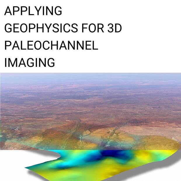
Applying geophysics for 3D paleochannel imaging
Dr Sara Jakica, Senior Geologist - Mapping Through Cover
29 October 2021
In predominantly arid Western Australia, paleochannels contain sand-dominated intervals that host water that is of potential interest to farmers, explorers and indigenous people. In many cases, the depth of the paleochannel marks the depth of cover above potentially prospective bedrock. The Cenozoic-era Yangibana paleochannel, composed dominantly of sands and clays, is incised into the Proterozoic granitic basement of the Gascoyne Province. This study demonstrates how the integration of different geophysical methods can improve the currently available paleochannel maps of Western Australia. The methods used in this study add depth information to the paleochannel geometry and increase its resolution.
From scientific gentlemen to professional geologists: GSWA’s origins and milestones.
Angela Riganti, Content Manager
24 September 2021
So-called ‘scientific gentlemen’ were poorly regarded in the early days of the Colony of Western Australia. Their role in the discovery of gold in the young Colony was eventually recognized, and so the Geological Survey of Western Australia (GSWA) was established in 1888. We will explore the captivating history and events that contributed to the founding of one of Western Australia’s oldest institutions. Come along as we take a look at some of the significant milestones achieved in the GSWA’s 133-year-long history.
Simon Johnson, Director Regional Geoscience
30 July 2021
The Geological Survey of Western Australia (GSWA) reprioritized its 2020–21 work program due to the impact of travel and operational restrictions imposed by the COVID-19 pandemic. By using its extensive geoscience datasets, GSWA’s Accelerated Geoscience Program (AGP) has delivered over 100 new interpretive datasets across all areas of geoscience in key regions of the State, as well as increasing accessibility and searchability to key State exploration databases. These products were designed to accelerate our understanding of the regions’ geology, mineral and energy prospectivity, to open up new areas that were previously considered unprospective, and to stimulate the exploration industry.
Oxygen isotopes trace the origins of Earth’s earliest continental crust
Yongjun Lu, Senior Geochronologist Isotope Acquisition
25 June 2021
How continents formed is vigorously debated in the Earth Science community. Although geologists know that water was an essential ingredient for continent formation, many have proposed this water would have come from the Earth’s surface via subduction zones, as on the modern Earth. However, new research led by the Geological Survey of Western Australia in collaboration with Curtin University, The University of Western Australia, Geoscience Australia and international specialists, shows that this water could actually have come from the mantle. This suggests that Earth may have once operated very differently than it does today, and contained more primordial water than previously thought. This research has been published in the journal Nature.
Physical property changes and geophysical signatures of mineral systems
Richard Chopping, Manager Geoscience Mapping Through Cover
21 May 2021
The passage of heat and mineralizing fluids to create a mineral system change the mineralogy of the rocks they interact with. This not only produces both the ore and the distal mineralogical changes characteristic of the system but, in turn, affects the physical properties of those rocks. As geophysical responses are the product of the physical properties of the rocks beneath the survey area, the mineralization changes can produce geophysical signatures.
3D structural modelling of the southern Perth Basin
Charmaine Thomas, Senior Geologist/Geophysicist
23 April 2021
A new 3D geological model of the southern Perth Basin including the offshore was released in 2019, and is the culmination of a project reinterpreting stratigraphic horizons and faults in seismic and drillhole data. The study area stretches from the Rockingham area in the north to Augusta in the south, and extends westwards into the offshore portion of the basin including offshore petroleum wells and as far east as the Darling scarp. The seismic interpretation and geomodel capture some important aspects of this part of the basin, including the immense throw on the Darling Fault (> 12 km in places), the deepening of the basin offshore, and the multiple phases of Gondwanan extension and rifting allowing thick packages of sediment to accumulate.
Geoheritage: protecting Western Australia’s rock stars
Dr Sarah Martin, Paleontologist
19 March 2021
Western Australia is endowed with an impressive array of geological and geomorphological features, from the world’s oldest terrestrial materials and oldest evidence for life, through ancient reefs, dinosaur footprints, meteorite impact sites, vast cave systems and spectacular gorges. These sites are an important part of the State’s heritage, being closely intertwined with Western Australia’s rich biological diversity, and human stories and history. Distributed widely across the State and varying greatly in size and scale, sites must be adequately identified and carefully managed to ensure these unique localities are accessible to future generations.
Despite considerable public knowledge of the needs for and mechanisms of biological and cultural conservation, there is far less awareness of geological heritage and conservation. This talk aims to introduce the concept of geoheritage, explain how these sites are identified and managed within the State of Western Australia, and suggest ways in which we can all be involved in protecting WA’s rock stars!
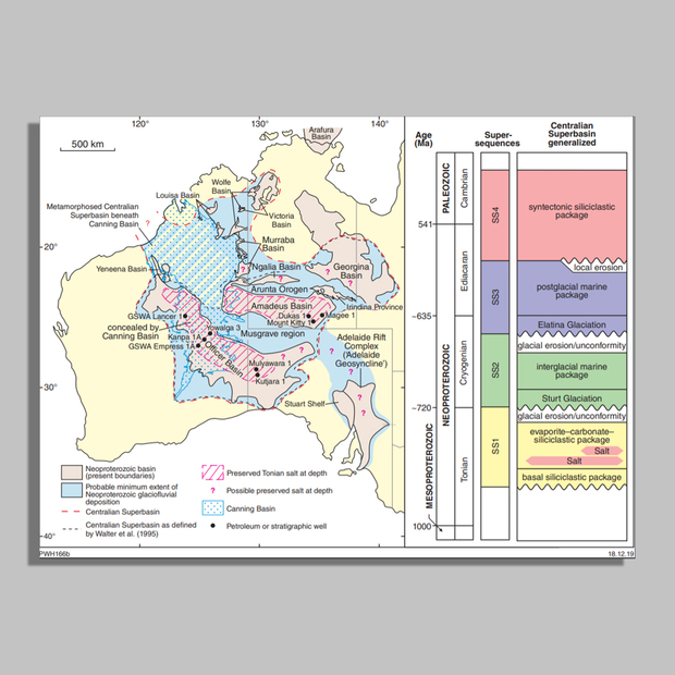
Potential for Neoproterozoic subsalt helium resources in Western Australia
Peter Haines, Basins Custodian
26 February 2021
Lower Neoproterozoic (c. 800 Ma) salt is widespread in the Officer and Amadeus Basins, and possibly the Murraba Basin. Although older preserved salt is known, these occurrences probably represent the oldest basin-scale salt seal in the world. This has implications not only for trapping subsalt hydrocarbons where a subsalt source rock is present, but also for basement-sourced helium. Two subsalt wells in the Northern Territory demonstrate this play type with gas flows containing 6% and 9% He, but both suffered from poor reservoir quality. Similar plays are likely in Western Australia, with good potential for subsalt reservoirs.
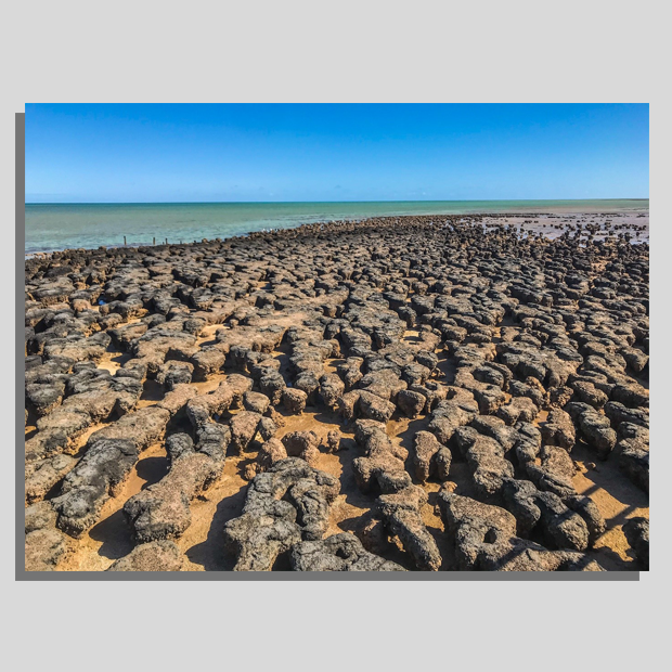
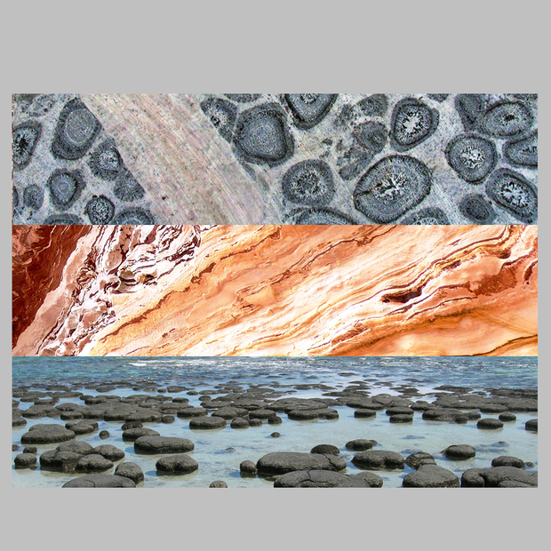
Western Australia’s wealth of microbialites
Heidi Allen, Paleontologist
11 December 2020
Western Australia is renowned for its wealth of microbialites, with living and fossil examples in relatively close proximity allowing comparative study. Living microbialites are best known from the World Heritage Area of Shark Bay, but have also been documented from a series of inland lakes including Lakes Thetis and Clifton. Western Australian fossil microbialites span the geological time scale from Paleoarchean to Recent, with the Strelley Pool and Dresser Formation stromatolites perhaps the most notable of these early records.
In this webinar, Paleontologist Heidi Allen will take you on a tour of significant Western Australian microbialite localities and explain how these tiny but mighty microbes helped shape the course of life on our planet.
Waukarlycarly 1 deep stratigraphic drilling
Leon Normore, Senior Geologist
20 November 2020
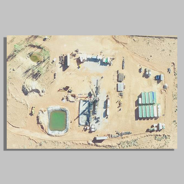
Following on from the 872 km onshore Kidson Sub-basin seismic survey is the 2680.5 m Waukarlycarly 1 deep stratigraphic well. This stratigraphic drilling provided continuous core from 580 to 2585 m throughout the Canning Basin stratigraphy and into highly weathered pre-Canning basement rocks, before final total depth into fresh, slightly metamorphosed dolomite. Wireline logs and a vertical seismic profile have also been completed for downhole correlation of well to seismic. This project has been funded by Geoscience Australia’s Exploring for the Future initiative and the Geological Survey of Western Australia’s Exploration Incentive Scheme.
A snapshot of the EIS Co-funded Drilling program: Rounds 1 to 17
Dr Charlotte Hall, EIS Coordinator
23 October 2020
After 10 years of the Western Australian Exploration Incentive Scheme Co-funded Drilling program, a short-term study has provided a snapshot of the statistics, results and impact of the program.
From Round 1 in 2009 to June 2019 when Round 19 projects completed drilling, 482 projects had been drilled across the State. Over 8767 drillholes, for a total of 847 km, are now supplying additional geological knowledge to de-risk exploration targeting and assist research. Diamond holes stored in a state core library number 677 and 43% of these holes, regardless of hole length, have been sampled by researchers providing an important add-on value. Thirty-five projects are reported as a reflection of the ‘success’ of the co-funding with several projects now operating, or in mine planning and feasibility stages.
GSWA's 20/21 Accelerated Geoscience Program
Jeff Haworth, Executive Director
2 October 2020
The advent of the COVID-19 pandemic has meant travel restrictions and a subsequent negative impact on exploration in Western Australia. The Geological Survey of Western Australia (GSWA) has therefore had to rethink its program for the 2020–21 financial year, to provide data and information quickly to enable the exploration industry to recover.
A recent Association of Mining and Exploration Companies (AMEC) report showed 72% of explorers had no investment and half the METS Engineering Group (METS) companies had ceased exploration operations. In addition to this, share prices for over half these companies has dropped 25–50%. The GSWA Accelerated Geoscience program will get information quickly to explorers to use and incentivise the METS sector. An increase of $5 million to the Exploration Incentive Scheme for geophysics acquisition will further stimulate the co-funded drilling program. The program will assist the critical minerals sector.
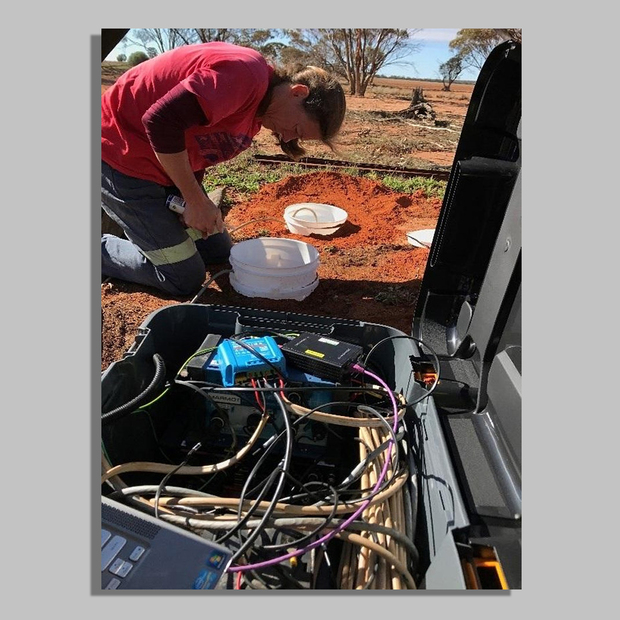
Seismic monitoring in the Wheatbelt
Dr Ruth Murdie, Senior 3D Geophysicist
25 September 2020
Southwest Australia has the highest level of seismicity in the whole of the continent, yet this is not an area where, geologically, we would expect earthquakes. GSWA is installing three new seismic monitoring stations in and around the Wheatbelt in order to better locate the numerous small earthquakes that happen on a regular basis.
Permanent seismic stations operated by Geoscience Australia automatically locate some of the larger of these events, but the sparsity of the national monitoring network means that the locations obtained are very poor. These new stations double the number in the region and should result in better locations, better identification of potential fault lines and seismic hazard.
Au–Cu mineralization at Obelisk, northern Paterson Orogen
Dr Paul Duuring, Senior Geologist
4 September 2020
A project update for a collaborative study with industry that examines the style and controls on Au-Cu mineralization at the Obelisk deposit in the northern Paterson Orogen.