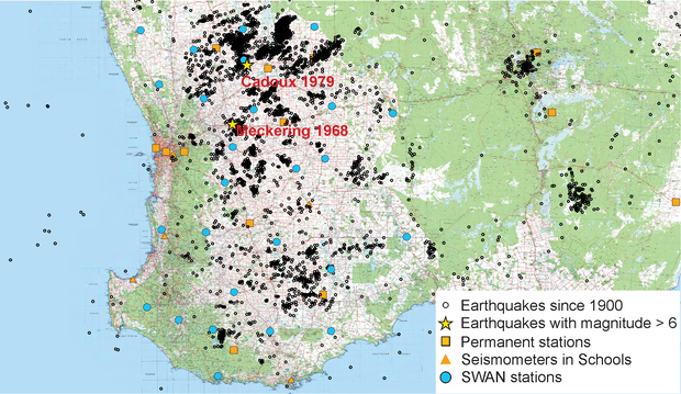
This multi-institutional project aims to improve the understanding of both seismic structure in the South West region of Western Australia and the nature of the earthquake behaviour in this seismically active region. Data from a network of 25 seismometers installed from Badgingarra to Lake King will be used to generate a 3D model of the continental lithosphere. The enhanced seismic coverage and understanding of structural controls will enable better location and characterisation of seismic events. In turn, this will allow modelling of ground motion patterns and likely magnitudes in specific areas — a fundamental for earthquake hazard assessments.
This project is a collaboration with the Australia National University, Geoscience Australia, and the Department of Fire and Emergency Services.
Contact
For further information contact:
geological.survey@dmirs.wa.gov.au
