More dates for 2017 have been added to the Programme of Work (PoW) spatial systems training calendar.
| Date: | Thursday, 28 September 2017 |
|---|
Recent feedback from participants in this year’s Programme of Work (PoW) spatial systems training has prompted the Department of Mines, Industry Regulation and Safety (DMIRS) to offer additional training sessions for stakeholders.
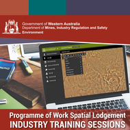
The new Programme of Work spatial system offers real time feedback, allowing all relevant information on the tenement(s) to be visible or accessible during the lodgement stage. The system will prompt information from the tenement holder during the lodgement process, ensuring adequate information is provided in the application. This reduces the likelihood of questions being raised during the assessment phase.
The new system will become mandatory by the end of the 2017-18 financial year for all exploration activities however Programme of Work prospecting (POW-P) forms will continue to be accepted in hard copy or online through DMIRS Submissions.
The updated map-based application allows users to enter their proposed activities, either by loading existing spatial files or creating spatial files on the screen. The system will conduct automatic checks by intersecting the proposed activities with other data layers of environmental and cultural significance, and alert the user with the results.
The department will run three more sessions before the end of 2017, two in Perth and one in Kalgoorlie; with 15 spaces available per session. More information regarding dates and locations can be found online and please email PoWSpatial@dmirs.wa.gov.au to register for the training.